Cova Lima Municipality
| Cova Lima Kovalima | ||
|---|---|---|
| Municipality | ||
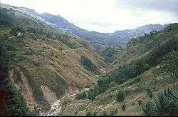 Mountain area in Cova Lima | ||
| ||
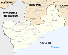
 Map of East Timor highlighting Cova Lima Municipality | ||
| Coordinates: 9°19′S 125°15′E / 9.317°S 125.250°ECoordinates: 9°19′S 125°15′E / 9.317°S 125.250°E | ||
| Country |
| |
| Capital | Suai | |
| Administrative posts | ||
| Area | ||
| • Total | 1,203 km2 (464 sq mi) | |
| Area rank | 7th | |
| Population (2015 census) | ||
| • Total | 65,301 | |
| • Rank | 9th | |
| • Density | 54/km2 (140/sq mi) | |
| • Density rank | 9th | |
| Households (2015 census) | ||
| • Total | 12,564 | |
| • Rank | 8th | |
| Time zone | UTC+09:00 (TLT) | |
| ISO 3166 code | TL-CO | |

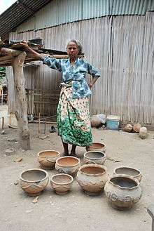
Woman with pottery in Cova Lima
Cova Lima (Portuguese: Município Cova Lima, Tetum: Munisípiu Kovalima) is a municipality of East Timor, in the Southwest part of the country. It has a population of 59,455 (Census 2010) and an area of 1,230 km².[1] The capital of the municipality is Suai, which lies 136 km from Dili, the national capital.[2] The administrative posts of Cova Lima are Fatululic, Fatumean, Fohorem, Zumalai, Maucatar, Suai, and Tilomar.[3]
Cova Lima borders the Timor Sea to the south, the municipalities of Bobonaro to the north, Ainaro to the east, and the Indonesian province of Nusa Tenggara Timur to the west.
 Subdivisions of Cova Lima
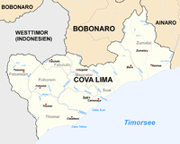 Cities and rivers of Cova Lima
 Borders of Cova Lima until 2003.
 Borders of Cova Lima since 2003.
References
- ↑ "Friends of Suai/Covalima" (PDF). City of Port Phillip. May 2014. Retrieved 2017-02-22.
- ↑ "Friends of Suai: Strategic Plan: 2010 to 2020" (PDF). City of Port Phillip. Retrieved 2017-02-22.
- ↑ Gunn, Geoffrey C (2011). "Cova Lima District". Historical Dictionary of East Timor. Lanham, Maryland: Scarecrow Press. p. 67. ISBN 9780810867543.
This article is issued from
Wikipedia.
The text is licensed under Creative Commons - Attribution - Sharealike.
Additional terms may apply for the media files.