Cotacachi Volcano
| Cotacachi | |
|---|---|
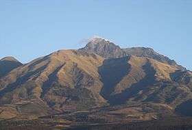 Cotacachi Volcano as seen from the city of Cotacachi | |
| Highest point | |
| Elevation | 4,944 m (16,220 ft) [1] |
| Prominence | 1,837 m (6,027 ft) [1] |
| Listing | Ultra |
| Coordinates | 00°21′39″N 78°20′57″W / 0.36083°N 78.34917°WCoordinates: 00°21′39″N 78°20′57″W / 0.36083°N 78.34917°W [1] |
| Geography | |
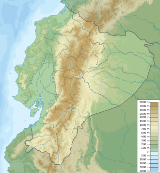 Cotacachi Ecuador | |
| Location | Ecuador |
| Parent range | Andes |
| Climbing | |
| First ascent | 24 April 1880 by Edward Whymper, Jean-Antoine Carrel and Louis Carrel |
Cotacachi is a dormant volcano in the Western Cordillera of the northern Ecuadorian Andes, in the west of Imbabura Province, above the city of Cotacachi. It has a summit elevation of 4,944 m (16,220 ft) above sea level and its highest elevations are capped with snow.
The summit of Cotacachi is located within the Cotacachi Cayapas Ecological Reserve. It was first climbed on 24 April 1880 by Edward Whymper, Jean-Antoine Carrel and Louis Carrel.[2]
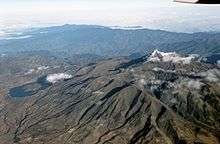
Aerial view of Cotacachi
See also
References
- 1 2 3 "Ecuador ultra-prominent peaks". peaklist.org. Retrieved 2013-07-02.
- ↑ Whymper, Edward. Travels Amongst the Great Andes of the Equator. John Murray, 1892, p.262.
External links
This article is issued from
Wikipedia.
The text is licensed under Creative Commons - Attribution - Sharealike.
Additional terms may apply for the media files.