Corris Uchaf
| Corris Uchaf | |
|---|---|
.jpg) Corris Uchaf | |
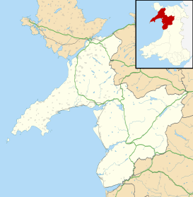 Corris Uchaf Corris Uchaf shown within Gwynedd | |
| OS grid reference | SH743088 |
| Community | |
| Principal area | |
| Ceremonial county | |
| Country | Wales |
| Sovereign state | United Kingdom |
| Post town | MACHYNLLETH |
| Postcode district | SY20 |
| Dialling code | 01654 |
| Police | North Wales |
| Fire | North Wales |
| Ambulance | Welsh |
| EU Parliament | Wales |
| UK Parliament | |
| Welsh Assembly | |
Corris Uchaf (English: Upper Corris), locally known as Top Corris, is a village lying in the south of the Snowdonia National Park in Gwynedd, Wales. The extensive slate quarries that surround the village are its most prominent historical feature.
The village lies in the valley of the Afon Deri, and is threaded by the A487 road, a trunk road between Dolgellau and Machynlleth. To the south the Deri runs into the Afon Dulas in the neighbouring village of Corris.
Among the quarries that once thrived around the village are Abercwmmeiddaw and Abercorris (also known as Cwmodyn) on the east bank of the river, and Gaewern and Braichgoch on the western slopes of the valley.
A narrow-gauge horse-drawn tramway carried slate in waggons from the quarries to Maespoeth Junction, where they joined the main line of the narrow gauge Corris Railway which took them onward to Machynlleth.
See also
References
External links
| Wikimedia Commons has media related to Corris Uchaf. |
- Eco Dyfi Valley Partnership
- Corris Craft Centre
- King Arthur's Labyrinth
- Historical links
- www.geograph.co.uk : photos of Corris Uchaf and surrounding area
