Corduroy Creek Bridge
| Corduroy Creek Bridge | |
|---|---|
 | |
| Coordinates | 34°06′25″N 110°09′11″W / 34.107°N 110.153°WCoordinates: 34°06′25″N 110°09′11″W / 34.107°N 110.153°W |
| Carries |
|
| Crosses | Corduroy Creek |
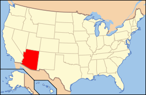
| Locale | near Show Low, Arizona |
| Characteristics | |
| Design | Deck arch |
| Material | Steel |
| Total length | 250 feet (76 m) |
| Width | 24 feet (7.3 m) |
| Longest span | 180 feet (55 m) |
| History | |
| Construction start | 1937 |
| Construction end | 1938 |
| Closed | 1994 |
|
Corduroy Creek Bridge | |
  | |
| Nearest city | Show Low, Arizona |
| Coordinates | 34°6′24″N 110°9′10″W / 34.10667°N 110.15278°WCoordinates: 34°6′24″N 110°9′10″W / 34.10667°N 110.15278°W |
| Built | 1937 |
| Architect | Pleasant-Hasler Construction Co. |
| Architectural style | Other |
| MPS | Vehicular Bridges in Arizona MPS |
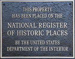
| NRHP reference # | 88001613 |
| Added to NRHP | September 30, 1988[1] |
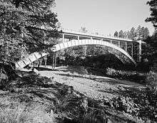
The Corduroy Creek Bridge was a steel arch highway bridge on US 60, located near Show Low, Arizona in Navajo County, Arizona.
History
The 180-foot span ribbed girder arch bridge was built in 1937-38 with a total length of 250 feet.
In 1994 the nearby Cedar Canyon Bridge was substantially widened and upgraded, using the identical arch from the Corduroy Creek bridge to double the width of the Cedar Canyon bridge while rehabilitating the deck structure.[2]
The Corduroy Creek bridge was replaced with an I-beam girder bridge.[3]
See also

- List of bridges on the National Register of Historic Places in Arizona
- National Register of Historic Places listings in Navajo County, Arizona
References
- ↑ National Park Service (2008-04-15). "National Register Information System". National Register of Historic Places. National Park Service.
- ↑ "Cedar Creek Bridger". Gallery of Arizona Bridges. Arizona Department of Transportation. 2008-11-07.
- ↑ "Cedar Canyon Bridge and Corduroy Creek Bridge". Arizona State University/Ron Foluch. 2008-11-07. Archived from the original on 2010-06-25.
External links
- Arizona DOT page on Cedar Canyon Bridge widening
- Cedar Canyon Bridge widening project
- Historic American Engineering Record (HAER) No. AZ-27, "Corduroy Creek Bridge, Spanning Corduroy Creek at Highway 60, Show Low vicinity, Navajo County, AZ", 29 photos, 23 data pages, 3 photo caption pages
| Wikimedia Commons has media related to Corduroy Creek Bridge. |
 |  | ||
This article is issued from
Wikipedia.
The text is licensed under Creative Commons - Attribution - Sharealike.
Additional terms may apply for the media files.