Cordillera Oriental (Bolivia)
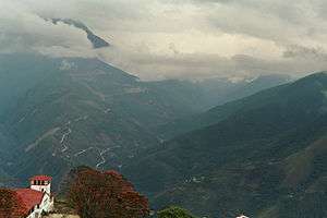
The Cordillera Oriental are parallel mountain ranges of the Bolivian Andes, emplaced on the eastern and north eastern margin of the Andes. Large parts of Cordillera Oriental are forested and humid areas rich in agricultural and livestock products. Geologically, the Cordillera Oriental is formed by the Central Andean fold and thrust belt.
The Bolivian tin belt lies in the cordillera.[1]
Division
The cordillera can be divided into three sections in Bolivia and one in northwestern Argentina:
- The northern section is a continuous mountain range like Eslabón, San Buenaventura, Muchane, Pilón, etc. and between its important summits you can find Astalaya and Cerro Colorado.
- The central section was formed entirely by the Cochabamba mountain range, this section crossing the department of Cochabamba forms the Yungas and the Chapare. Its major summits include Tunari at approximately 5,200 meters and San Benito with 4,298 meters. It extends from the department of Santa Cruz, forming the isolated mountain ranges like Mataracu, San Rafael, Las Juntas, Los Volcanes, these all ending in Amboró National Park.
- The southern section starts north of Chuquisaca with the Presto mountain range and ending in the Caiza and Capirenda mountain ranges in Gran Chaco province in the department of Tarija. The easternmost range of the southern section and the Bolivian Andes is Serranía del Aguaragüe. The southern section does not contain representative summits.
- The Cordillera Oriental extends into Argentina, where it is found from north to south in the provinces of Jujuy, Salta and the northern part of Tucumán Province.[2]
See also
References
- ↑ Mlynarczyk, Michael S.J.; Williams-Jones, Anthony E. (2005). "The role of collisional tectonics in the metallogeny of the Central Andean tin belt". Earth and Planetary Science Letters. 240: 656–667. Bibcode:2005E&PSL.240..656M. doi:10.1016/j.epsl.2005.09.047.
- ↑ Payrola Bosio et al., 2010, p.310
Bibliography
- Payrola Bosio, Patricio Augusto; Cecilia del Papa; Fernando Hongn, and Jaime Powell. 2010. Estratigrafía del Valle de Luracatao (Valle Calchaquí, Noroeste Argentino): Nueva propuesta. Revista de la Asociación Geológica Argentina 67. 309–318. Accessed 2018-09-07.
This article is issued from
Wikipedia.
The text is licensed under Creative Commons - Attribution - Sharealike.
Additional terms may apply for the media files.