Coquitlam Town Centre
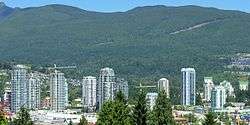
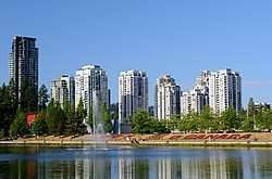
Coquitlam Town Centre is the main commercial and retail neighbourhood for the city of Coquitlam, British Columbia. Coquitlam Town Centre covers 715 hectares (1,767 acres) and contains the highest concentration of high-rise condominiums in the Tri-Cities and Eastern Metro Vancouver which includes the cities of Port Moody, Anmore, Belcarra, Port Coquitlam, Pitt Meadows, Maple Ridge, Surrey, White Rock, Langley (City), Langley (District Municipality) and Coquitlam.[1][2]
Geography
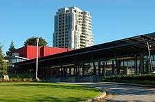
Geographically, Coquitlam has two large parcels of land (one in the south-west, the other in the north-east), with a smaller central area between them. This central area, Coquitlam Town Centre, was designated as a "Regional Town Centre" under the Metro Vancouver's Livable Region Strategic Plan. The concept of a town centre for the area dates back to 1975. The intent is to have a concentration of high-density housing, offices, cultural, entertainment and education facilities to serve major growth areas of the region, served by rapid transit service. Coquitlam Town Centre is currently undergoing an update of the Town Centre plan.[3]
Population
The Population of Coquitlam's City Centre as of the 2006 census is 24,105 and the population density was 3,284 people/km2 (13.3/acre).
Rapid Transit
Evergreen Extension
Three stations for the Evergreen Extension are in operation in the town centre - Coquitlam Central, Lincoln, and Lafarge Lake-Douglas Station, which is the terminus of the SkyTrain line.
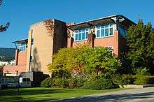
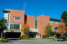
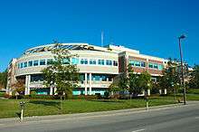
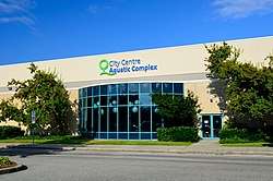
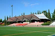
Facilities
Public facilities presently at the Town Centre Park area include:
 Police Station |
 Fire Hall | ||
 Innovation Centre |
|||

Parks
Retail and Shopping
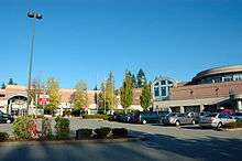
Coquitlam Centre - constructed in 1979 is the main mall in the city centre.
Other major retail centres:
- Pinetree Village
- Sunwood Square
- Henderson Place Mall
- Westwood Mall
- Various mini malls in the Glen and Johnson area
Schools
In or less than 1 km of the town centre
Elementary
- Glen Elementary
- Walton Elementary
- Nestor Elementary
Middle
- Maple Creek Middle
- Scott Creek Middle
Secondary
College
- Douglas College (David Lam Campus)
References
- ↑ Metro Vancouver: Coquitlam Town Centre Archived July 10, 2010, at the Wayback Machine. Retrieved on 1 March 2009
- ↑ City of Coquitlam: Retail Retrieved on 1 March 2009
- ↑ City of Coquitlam: City Centre Area Plan Retrieved on 4 January 2009
Coordinates: 49°17′29″N 122°47′26″W / 49.2915°N 122.7906°W