Coombe Keynes
| Coombe Keynes | |
|---|---|
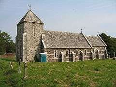 Holy Rood parish church | |
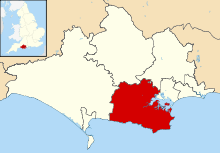
 Coombe Keynes Coombe Keynes shown within Dorset | |
| Population | 80 |
| OS grid reference | SY842842 |
| District | |
| Shire county | |
| Region | |
| Country | England |
| Sovereign state | United Kingdom |
| Post town | Wareham |
| Postcode district | BH20 5PP |
| Dialling code | 01929 |
| Police | Dorset |
| Fire | Dorset and Wiltshire |
| Ambulance | South Western |
| EU Parliament | South West England |
| UK Parliament | |
| Website | Coombe Keynes Community web site |
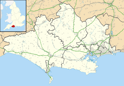
Coombe Keynes is a hamlet, civil parish and depopulated village in the Purbeck district of Dorset, England. The village is about 2 miles (3 km) south of Wool and about 5 miles (8 km) west-south-west of Wareham.
In 2013 the population of the civil parish was estimated to be 80.[1] There are 22 houses in the hamlet and 37 properties in the parish as a whole.
History
Coombe Keynes was part of Winfrith Hundred. The Domesday Book of 1086 records it as Cume, held by Gilbert de Magminot, Bishop of Lisieux.[2] The name Keynes derives from the later Lords of the Manor, the de Cahaignes family, who also held Tarrant Keyneston.
Later Coombe Keynes' population declined until it is now only a hamlet. The lost part of the settlement was immediately east of the parish church. The area is now a field what appear to be platforms where cottages stood and a hollow way that would have been a lane. This depopulated area is now a Scheduled Ancient Monument.[3]
The Church of England parish church of the Holy Rood was formerly the centre of a large parish that included the village of Wool. In 1844 Wool was made into a separate parish. The two ecclesiastical parishes were recombined in 1967.[4]
The chancel arch and west tower of Holy Rood church is 13th-century. The rest of the church was rebuilt in 1860–61 to designs by Thomas Hicks. It is a Gothic Revival building with nave, chancel and north porch.[5] It was deconsecrated in 1974 and is now used as a secular function room managed by the Coombe Keynes Trust.[6]
The Coombe Keynes Chalice, a rare pre-Reformation chalice with an octagonal foot with embellished angles on the stem, is now kept in the Victoria and Albert Museum.[7]
References
- ↑ "Parish Population Data". Dorset County Council. 20 January 2015. Archived from the original on 2 November 2014. Retrieved 11 February 2015.
- ↑ "Coombe Keynes". Domesday Map. Archived from the original on 2012-07-29.
- ↑ Historic England. "Medieval settlement east of Holy Rood Church (1017260)". National Heritage List for England. Retrieved 11 June 2017.
- ↑ "Coombe Keynes". Dorset Online Parish Clerks.
- ↑ Historic England. "Former Church of the Holy Rood (Grade II) (1120491)". National Heritage List for England. Retrieved 11 June 2017.
- ↑ "The Coombe Keynes Trust". Retrieved 11 June 2017.
- ↑ "The Coombe Keynes Chalice". Victoria and Albert Museum.
Further reading
- Newman, John; Pevsner, Nikolaus (1972). Dorset. The Buildings of England. Harmondsworth: Penguin Books. p. 161. ISBN 0-14-071044-2.
- RCHME, ed. (1970). An Inventory of the Historical Monuments in Dorset. 2, South East. London: Her Majesty's Stationery Office. pp. 49–52.
External links
| Wikimedia Commons has media related to Coombe Keynes. |