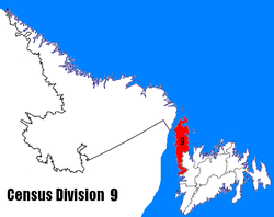
Cook's Harbour
| Cook's Harbour | |
|---|---|
| Town | |
| Coordinates: 51°36′28″N 55°51′50″W / 51.60778°N 55.86389°W | |
| Country |
|
| Province |
|
| Area | |
| • Land | 1.95 km2 (0.75 sq mi) |
| Population (2016)[1] | |
| • Total | 123 |
| • Density | 62.9/km2 (163/sq mi) |
| Time zone | UTC-3:30 (Newfoundland Time) |
| • Summer (DST) | UTC-2:30 (Newfoundland Daylight) |
| Area code(s) | 709 |
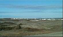
Cook's Harbour is a town in the Canadian province of Newfoundland and Labrador. The town had a population of 123 in the Canada 2016 Census.[1]
History
Cook's Harbour was named by Captain James Cook in 1764, during his survey of Newfoundland.[2]
References
- 1 2 "Census Profile, 2016 Census". Statistics Canada. February 14, 2017. Retrieved February 15, 2017.
- ↑ "Cook's Harbour". Land of First Contact. 2014. Retrieved 2014-10-10.
Coordinates: 51°36′28″N 55°51′50″W / 51.60778°N 55.86389°W
| Towns |
|  |
|---|---|---|
| Unorganized subdivisions |
| |
This article is issued from
Wikipedia.
The text is licensed under Creative Commons - Attribution - Sharealike.
Additional terms may apply for the media files.