Conway, North Dakota
| Conway, North Dakota | |
|---|---|
| City | |
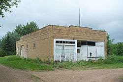 An old service station in Conway | |
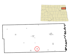 Location of Conway, North Dakota | |
| Coordinates: 48°14′2″N 97°40′29″W / 48.23389°N 97.67472°WCoordinates: 48°14′2″N 97°40′29″W / 48.23389°N 97.67472°W | |
| Country | United States |
| State | North Dakota |
| County | Walsh |
| Founded | 1885 |
| Area[1] | |
| • Total | 0.22 sq mi (0.57 km2) |
| • Land | 0.22 sq mi (0.57 km2) |
| • Water | 0 sq mi (0 km2) |
| Elevation | 981 ft (299 m) |
| Population (2010)[2] | |
| • Total | 23 |
| • Estimate (2016)[3] | 22 |
| • Density | 100/sq mi (40/km2) |
| Time zone | UTC-6 (Central (CST)) |
| • Summer (DST) | UTC-5 (CDT) |
| ZIP code | 58233 |
| Area code(s) | 701 |
| FIPS code | 38-15820 |
| GNIS feature ID | 1028443[4] |
Conway is a city in Walsh County, North Dakota, United States. The population was 23 at the 2010 census.[5] Conway was founded in 1885.
Geography
Conway is located at 48°14′2″N 97°40′29″W / 48.23389°N 97.67472°W (48.233996, -97.674728).[6]
According to the United States Census Bureau, the city has a total area of 0.22 square miles (0.57 km2), all of it land.[1]
Demographics
| Historical population | |||
|---|---|---|---|
| Census | Pop. | %± | |
| 1900 | 216 | — | |
| 1910 | 184 | −14.8% | |
| 1920 | 148 | −19.6% | |
| 1930 | 100 | −32.4% | |
| 1940 | 120 | 20.0% | |
| 1950 | 107 | −10.8% | |
| 1960 | 67 | −37.4% | |
| 1970 | 57 | −14.9% | |
| 1980 | 33 | −42.1% | |
| 1990 | 24 | −27.3% | |
| 2000 | 23 | −4.2% | |
| 2010 | 23 | 0.0% | |
| Est. 2016 | 22 | [3] | −4.3% |
| U.S. Decennial Census[7] 2014 Estimate[8] | |||
2010 census
As of the census[2] of 2010, there were 23 people, 13 households, and 6 families residing in the city. The population density was 104.5 inhabitants per square mile (40.3/km2). There were 15 housing units at an average density of 68.2 per square mile (26.3/km2). The racial makeup of the city was 100.0% White.
There were 13 households of which 23.1% had children under the age of 18 living with them, 38.5% were married couples living together, 7.7% had a male householder with no wife present, and 53.8% were non-families. 53.8% of all households were made up of individuals and 23.1% had someone living alone who was 65 years of age or older. The average household size was 1.77 and the average family size was 2.67.
The median age in the city was 46.5 years. 17.4% of residents were under the age of 18; 4.3% were between the ages of 18 and 24; 17.3% were from 25 to 44; 21.6% were from 45 to 64; and 39.1% were 65 years of age or older. The gender makeup of the city was 47.8% male and 52.2% female.
2000 census
At the 2000 census, there were 23 people, 9 households and 7 families residing in the city. The population density was 105.2 per square mile (40.4/km²). There were 11 housing units at an average density of 50.3 per square mile (19.3/km²). The racial makeup of the city was 100.00% White. The ancestry make up was 55.2% Czech, 31.0% Irish, 31.0% Norwegian, 20.7% Dutch, 6.9% Danish, 6.9% German, 6.9% French.
There were 9 households of which 33.3% had children under the age of 18 living with them, 55.6% were married couples living together, 11.1% had a female householder with no husband present, and 22.2% were non-families. 22.2% of all households were made up of individuals and 22.2% had someone living alone who was 65 years of age or older. The average household size was 2.56 and the average family size was 3.00.
30.4% of the population were under the age of 18, 26.1% from 25 to 44, 17.4% from 45 to 64, and 26.1% who were 65 years of age or older. The median age was 36 years. For every 100 females, there were 53.3 males. For every 100 females age 18 and over, there were 77.8 males.
The median household income was $20,833 and the median family income was $22,083. Males had a median income of $33,750 compared with $16,875 for females. The per capita income for the city was $9,176. There were no families and 10.3% of the population living below the poverty line, including no under eighteens and 42.9% of those over 64.
References
- 1 2 "US Gazetteer files 2010". United States Census Bureau. Archived from the original on 2012-01-24. Retrieved 2012-06-14.
- 1 2 "American FactFinder". United States Census Bureau. Retrieved 2013-05-28.
- 1 2 "Population and Housing Unit Estimates". Retrieved June 9, 2017.
- ↑ "US Board on Geographic Names". United States Geological Survey. 2007-10-25. Retrieved 2008-01-31.
- ↑ "2010 Census Redistricting Data (Public Law 94-171) Summary File". American FactFinder. United States Census Bureau. Archived from the original on 21 July 2011. Retrieved 2 May 2011.
- ↑ "US Gazetteer files: 2010, 2000, and 1990". United States Census Bureau. 2011-02-12. Retrieved 2011-04-23.
- ↑ United States Census Bureau. "Census of Population and Housing". Archived from the original on May 12, 2015. Retrieved January 19, 2014.
- ↑ "Population Estimates". United States Census Bureau. Retrieved June 6, 2015.
Municipalities and communities of Walsh County, North Dakota, United States | ||
|---|---|---|
| Cities |  | |
| Townships | ||
| CDPs | ||
| Unincorporated communities | ||