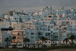
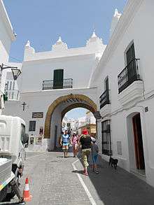
Conil de la Frontera
| Conil | |||
|---|---|---|---|
| Municipality | |||
 | |||
| |||
 Conil Location in Spain | |||
| Coordinates: 36°16′N 6°5′W / 36.267°N 6.083°WCoordinates: 36°16′N 6°5′W / 36.267°N 6.083°W | |||
| Country |
| ||
| Autonomous community |
| ||
| Province | Cádiz | ||
| Comarca | La Janda | ||
| Government | |||
| • Mayor | Antonio Jesús Roldán Muñoz (Izquierda Unida) | ||
| Area | |||
| • Total | 88.51 km2 (34.17 sq mi) | ||
| Elevation | 41 m (135 ft) | ||
| Population (2018) | |||
| • Total | 35,297 | ||
| • Density | 400/km2 (1,000/sq mi) | ||
| Demonym(s) | Conileños | ||
| Time zone | UTC+1 (CET) | ||
| • Summer (DST) | UTC+2 (CEST) | ||
| Postal code | 11140 | ||
| Website | Official website | ||

Conil de la Frontera is a town on the Atlantic coast in the southern part of Spain, with around 22,000 inhabitants.
.jpg)

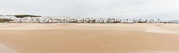
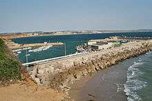
It has six beaches: Playa La Fontanilla, Playa El Roqueo (with a 1936 Civil War bunker), Playa Fuente del Gallo, Playa Punta Lejos, Playa Cala del Aceite and Playa los Bateles. Playa los Bateles is the longest and the most popular in the summer. Conil de la Frontera is primarily a vacation town and the most of the tourists are Spanish although you often also hear German as well in town.
Every Friday you can visit the market on Avda. de la Música, which includes culture and history. The market includes lots of little trinkets and handmade clothes. The beach has volleyball nets and lots and lots of sand. The Beach is a nice place to go if you're wanting a vacation getaway.[1]
Panorama
References
| Wikimedia Commons has media related to Conil de la Frontera. |