Conic Island
| Native name: 饭甑洲 | |
|---|---|
 Conic Island | |
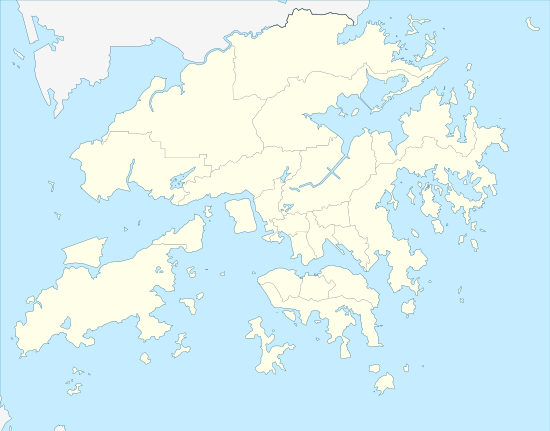 Conic Island Location of Conic Island in Hong Kong | |
| Geography | |
| Coordinates | 22°21′49.32″N 114°23′29.76″E / 22.3637000°N 114.3916000°ECoordinates: 22°21′49.32″N 114°23′29.76″E / 22.3637000°N 114.3916000°E |
| Length | 300 m (1,000 ft) |
| Width | 100 m (300 ft) |
| Coastline | 780 m (2,560 ft) |
| Highest elevation | 50 m (160 ft) |
| Administration | |
| District | Sai Kung |
| Demographics | |
| Population | 0 |
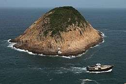
Conic Island (Chinese: 饭甑洲) is a small uninhabited island in Sai Kung District, Hong Kong.
Located within Sai Kung East Country Park, the island lies a few hundred metres east of Tsang Pang Kok, Long Ke Wan. It is visible from Tsang Pang Kok, the East Dam of the High Island Reservoir, the eastern end of Man Yee Road as well as at the end of Stage 1 of the MacLehose Trail. There is a small lighthouse and a basic dock on the island.[1]
Its Chinese name derives from it being in the shape of Zeng (甑), a crockery used in ancient times in steaming rice.
References
| Wikimedia Commons has media related to Conic Island, Hong Kong. |
This article is issued from
Wikipedia.
The text is licensed under Creative Commons - Attribution - Sharealike.
Additional terms may apply for the media files.