Concord (CDP), Vermont
| Concord, Vermont | |
|---|---|
| Census-designated place | |
_highlighted.svg.png) Location in Essex County and the state of Vermont. | |
| Coordinates: 44°25′43″N 71°53′18″W / 44.42861°N 71.88833°WCoordinates: 44°25′43″N 71°53′18″W / 44.42861°N 71.88833°W | |
| Country | United States |
| State | Vermont |
| County | Essex |
| Town | Concord |
| Area[1] | |
| • Total | 1.13 sq mi (2.92 km2) |
| • Land | 1.10 sq mi (2.85 km2) |
| • Water | 0.03 sq mi (0.07 km2) |
| Elevation | 880 ft (270 m) |
| Population (2010)[1] | |
| • Total | 271 |
| • Density | 247/sq mi (95.2/km2) |
| Time zone | UTC-5 (Eastern (EST)) |
| • Summer (DST) | UTC-4 (EDT) |
| ZIP code | 05824[2] |
| Area code(s) | 802 |
| GNIS feature ID | 1456992[3] |
| FIPS code | 50-15175 |
Concord is a census-designated place comprising the main settlement in the town of Concord, Essex County, Vermont, United States. As of the 2010 census, it had a population of 271,[1] out of a total town population of 1,235.
The Concord CDP is in the western part of the town of Concord, along the Moose River, a west-flowing tributary of the Passumpsic River and part of the Connecticut River basin. U.S. Route 2 passes through the center of the CDP, leading west 8 miles (13 km) to St. Johnsbury and east 20 miles (32 km) to Lancaster, New Hampshire.
The Concord CDP has a total area of 1.1 square miles (2.9 km2), of which 0.027 square miles (0.07 km2), or 2.50%, is water.[1]
References
- 1 2 3 4 "Geographic Identifiers: 2010 Census Summary File 1 (G001): Concord CDP, Vermont". American Factfinder. U.S. Census Bureau. Retrieved April 8, 2016.
- ↑ United States Postal Service (2016). "USPS - Look Up a ZIP Code". Retrieved April 8, 2016.
- ↑ "Canaan". Geographic Names Information System. United States Geological Survey.
Municipalities and communities of Essex County, Vermont, United States | ||
|---|---|---|
| Towns | 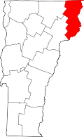 | |
| CDPs | ||
| Grants and gores | ||
| Other communities | ||
| Footnotes | ‡ Unorganized | |
This article is issued from
Wikipedia.
The text is licensed under Creative Commons - Attribution - Sharealike.
Additional terms may apply for the media files.