Compton Abbas Airfield
| Compton Abbas Airfield | |||||||||||
|---|---|---|---|---|---|---|---|---|---|---|---|
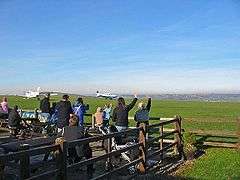 Spectators outside the clubhouse | |||||||||||
| Summary | |||||||||||
| Airport type | Private | ||||||||||
| Operator | Compton Abbas Airfield Ltd | ||||||||||
| Serves | Shaftesbury | ||||||||||
| Location | Compton Abbas | ||||||||||
| Elevation AMSL | 811 ft / 247 m | ||||||||||
| Coordinates | 50°58′02″N 002°09′13″W / 50.96722°N 2.15361°WCoordinates: 50°58′02″N 002°09′13″W / 50.96722°N 2.15361°W | ||||||||||
| Map | |||||||||||
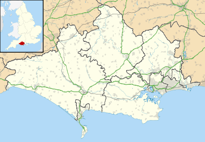 EGHA Location in Dorset | |||||||||||
| Runways | |||||||||||
| |||||||||||
Compton Abbas Airfield (IATA: n/a, ICAO: EGHA) is located 2.7 NM (5.0 km; 3.1 mi) south of Shaftesbury, Dorset, England.
Compton Abbas Aerodrome has a CAA Ordinary Licence (Number P851) that allows flights for the public transport of passengers or for flying instruction as authorised by the licensee (Compton Abbas Airfield Limited). The aerodrome is not licensed for night use.[2]
It was from this airfield in May 1993 that tycoon Asil Nadir flew to France in a six-seater Piper Seneca as he fled to Northern Cyprus.[3]
References
External links
| Wikimedia Commons has media related to Compton Abbas Airfield. |
This article is issued from
Wikipedia.
The text is licensed under Creative Commons - Attribution - Sharealike.
Additional terms may apply for the media files.