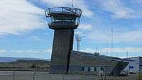
Comandante Armando Tola International Airport
| Comandante Armando Tola International Airport Aeropuerto Internacional de El Calafate – Comandante Armando Tola | |||||||||||
|---|---|---|---|---|---|---|---|---|---|---|---|
 | |||||||||||
| Summary | |||||||||||
| Airport type | Public / Military | ||||||||||
| Operator | Government and London Supply | ||||||||||
| Serves | El Calafate, Santa Cruz | ||||||||||
| Location | Camino al Aeropuerto, km 23. (Z9405) El Calafate | ||||||||||
| Elevation AMSL | 669 ft / 204 m | ||||||||||
| Coordinates | 50°16′48.90″S 72°03′11.50″W / 50.2802500°S 72.0531944°WCoordinates: 50°16′48.90″S 72°03′11.50″W / 50.2802500°S 72.0531944°W | ||||||||||
| Map | |||||||||||
 FTE Location of airport in Argentina | |||||||||||
| Runways | |||||||||||
| |||||||||||
| Statistics (2016) | |||||||||||
| |||||||||||
Comandante Armando Tola International Airport (Spanish: Aeropuerto Internacional de El Calafate – Comandante Armando Tola) (IATA: FTE, ICAO: SAWC) is an airport in Santa Cruz Province, Argentina. It is located approximately 21 km (13 mi) east of the city of El Calafate. The airport is jointly operated by the government and London Supply. Currently, the airport is served by Aerolíneas Argentinas, LAN Argentina, and LADE. It is the westernmost Argentinian airport served by scheduled flights.
The airport was inaugurated in November 2000, replacing the old Lago Argentino Airport (ING/SAWL). It is now the main entrance to Los Glaciares National Park. The airport's design was created by Carlos Ott, a famous architect from Uruguay. In 2010, the airport was used by over 500,000 passengers.
It was the departure and landing station for the second stage of Perlan Project [2]
Airlines and destinations
The airport is a common stopover for flights to Ushuaia
| Airlines | Destinations |
|---|---|
| Aerolíneas Argentinas | Buenos Aires-Aeroparque, Buenos Aires-Ezezia Seasonal: Córdoba, Rosario, San Carlos de Bariloche, Ushuaia |
| Aerovias DAP | Seasonal Punta Arenas, Puerto Natales (all begin November 30, 2017)[3] |
| LADE | Buenos Aires-Aeroparque, Comodoro Rivadavia, Gobernador Gregores, Mar del Plata, Puerto Madryn, Río Gallegos, Río Grande, San Carlos de Bariloche, Ushuaia |
| LATAM Argentina | Buenos Aires-Aeroparque, Ushuaia |
Statistics
| Passengers | Change from previous year | Aircraft operations | Change from previous year | Cargo (metric tons) | Change from previous year | |
|---|---|---|---|---|---|---|
| 2005 | 383,641 | 4,304 | 157 | |||
| 2006 | 407,874 | 4,387 | 150 | |||
| 2007 | 433,589 | 5,255 | 112 | |||
| 2008 | 494,722 | 6,355 | 120 | |||
| 2009 | 481,690 | 6,482 | 132 | |||
| 2010 | 507,482 | 6,589 | N.A. | N.A. | ||
| Source: Airports Council International. World Airport Traffic Statistics (Years 2005-2010) | ||||||
References
- ↑ Airport Council International 2010 World Airport Traffic Report
- ↑ https://en.wikipedia.org/wiki/Perlan_Project#Airbus_Perlan_Mission_II
- ↑ Aerovias DAP adds Patagonia