Columbia Peak
| Columbia Peak | |
|---|---|
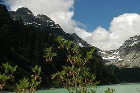 This image shows Columbia Peak on the left, and Columbia Glacier on the right with Blanca Lake in the foreground, looking North.[1] | |
| Highest point | |
| Elevation | 7,172 ft (2,186 m) NGVD 29[2] |
| Prominence | 1,132 ft (345 m) [2] |
| Coordinates | 47°57′42″N 121°21′40″W / 47.9617739°N 121.3612182°WCoordinates: 47°57′42″N 121°21′40″W / 47.9617739°N 121.3612182°W [3] |
| Geography | |
 Columbia Peak | |
| Parent range | Cascade Range |
| Topo map | USGS Blanca Lake |
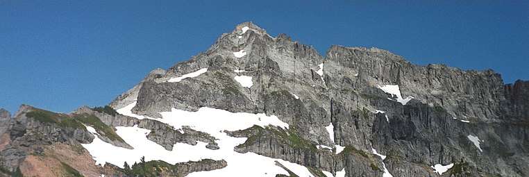
Columbia Peak is a mountain peak in the Henry M. Jackson Wilderness in the U.S. state of Washington. Columbia Peak rises to 7,172 feet (2,186 m). Together with Monte Cristo Peak and Kyes Peak it forms a basin that contains Columbia Glacier and Blanca Lake.[1]
References
- 1 2 Blanca Lake quadrangle, Washington (Map). 1:24000. 7.5 Minute Topographic. USGS.
- 1 2 "Columbia Peak, Washington". Peakbagger.com.
- ↑ "Columbia Peak". Geographic Names Information System. United States Geological Survey.
Gallery
This article is issued from
Wikipedia.
The text is licensed under Creative Commons - Attribution - Sharealike.
Additional terms may apply for the media files.