Sierra de Codés
| Codés Range | |
|---|---|
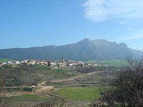 Codés range rising behind Aguilar de Codés | |
| Highest point | |
| Elevation | 1,418 m (4,652 ft) |
| Coordinates | 42°38′0″N 2°21′15″W / 42.63333°N 2.35417°WCoordinates: 42°38′0″N 2°21′15″W / 42.63333°N 2.35417°W |
| Geography | |
| Location | Navarre, Spain |
| Parent range | Basque mountains |
| Climbing | |
| First ascent | unknown |
| Easiest route | climb |
The Codés Range (Kodesko mendilerroa in Basque and Sierra de Codés in Spanish) is a mountain range of western Navarre, Spain, part of the Basque Mountains. Its highest point is the 1,418 metres high Ioar,[1] located between Santa Cruz de Campezo and Aguilar de Codés. The Codés Range is the westernmost mountain range in Navarre, located right at the limit of Álava Province.
The Santuario de Nuestra Señora de Codés is located in this mountain range, within the Torralba del Río municipal term.[2]
Together with the neighboring Andia and Urbasa ranges further north, Codés summits are usually covered in snow in the winter.
Summits
- Ioar, 1,418 m
- Kodes, 1,414 m
- Grudo, 1,363 m
- Laplana, 1,337 m
- Peña Blanca, 1,249 m
- San Cristobal, 1,245 m
- Costalera, 1,234 m
- Peña Redonda, 1,207 m
- Peña Gallet, 1,158 m
- Humada, 1,155 m
- Malpica, 1,087 m
- La Cogolla, 1,072 metro
References
- Sanz de Acedo, Alicia; Ganuza Chasco, Rufo, Sierras de Urbasa, Andía, Lokiz y Codés, ISBN 978-84-95368-40-9. Editorial El Senderista.
External links
| Wikimedia Commons has media related to Sierra de Codés. |
This article is issued from
Wikipedia.
The text is licensed under Creative Commons - Attribution - Sharealike.
Additional terms may apply for the media files.