Clarina Village
| Clarina Clár Aidhne | |
|---|---|
| Village | |
 Clarina Location in Ireland | |
| Coordinates: 52°38′02″N 08°43′47″W / 52.63389°N 8.72972°WCoordinates: 52°38′02″N 08°43′47″W / 52.63389°N 8.72972°W | |
| Country |
|
| Province | Munster |
| County | County Limerick |
| Time zone | UTC+0 (WET) |
| • Summer (DST) | UTC-1 (IST (WEST)) |
Clarina (Irish: Clár Aidhne) is a village in County Limerick in the province of Munster, Ireland.[1] It lies between Mungret and Kildimo on the N69 National Route about 6 miles west of Limerick city close to the River Maigue. The Maigue is a tributary of the River Shannon and enters the Shannon estuary between Limerick city and the mouth of the Deel river, Askeaton, county Limerick.
Clarina is within the Patrickswell-Ballybrown parish. The main area of interest is the nearby location of Carrigogunnell Castle.
Schools
Clarina has a National School called St. Josephs N.S (mixed),[2]
History
- see also Carrigogunnell Castle
Clarina Castle - Also known as Elm Park. Designed by the Pains, for 3rd Baron Clarina, in the late 1820s with further work by Rawson Carroll in the 1880s. Demolished in the 1960s [3][4]
See also
References
- ↑ "Placenames Database of Ireland". Dublin City University. Retrieved 13 November 2014.
- ↑ St. Josephs National School Web site
- ↑ http://archiseek.com/2012/clarina-castle-co-limerick/
- ↑ http://www.limerickcity.ie/media/Media,4111,en.pdf
External links
Places in County Limerick | ||
|---|---|---|
| Cities | 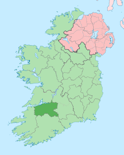 | |
| Towns | ||
| Villages and townlands |
| |
| ||