Citadel of the Hồ Dynasty
| UNESCO World Heritage site | |
|---|---|
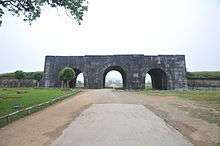
 The South (fore) gate of Tay Do castle | |
| Location | Tây Giai, Vĩnh Lộc District, Thanh Hóa Province, North Central Coast, Vietnam |
| Includes |
|
| Criteria | Cultural: (ii), (iv) |
| Reference | 1358 |
| Inscription | 2011 (35th Session) |
| Area | 155.5 ha (384 acres) |
| Buffer zone | 5,078.5 ha (12,549 acres) |
| Coordinates | 20°4′41″N 105°36′17″E / 20.07806°N 105.60472°ECoordinates: 20°4′41″N 105°36′17″E / 20.07806°N 105.60472°E |
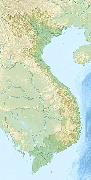 Location of Citadel of the Hồ Dynasty in Vietnam | |
Citadel of the Hồ Dynasty (Vietnamese: Thành nhà Hồ, Hán Nôm: 城家胡; also called Tây Đô castle or Tây Giai castle) is a citadel in Vietnam, constructed by the Hồ Dynasty (1400-1407).
It is located in Tây Giai commune, Vĩnh Lộc District, in Thanh Hóa Province, in Vietnam's North Central Coast region.
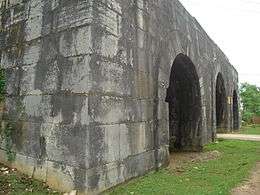
Tây Đô castle is rectangular in shape. Its north-south side is 870.5 m (2,856 ft) in length and its east-west side is 883.5 m (2,899 ft) in length. There are four gates: one at the south (fore gate), one at the north (back gate), one at the east (left gate), and one at the west (right gate). The southern gate is 9.5 m (31 ft) high and 15.17 m (49.8 ft) wide.
The castle was constructed from stone blocks, each of which is 2×1×0.7 m (6.6×3.3×2.3 ft) size on average.
Except for its gates, the castle is mostly ruined.
The Citadel was inscribed on UNESCO World Heritage Sites on June 27, 2011.[1]
Gallery
 General view
- South gate
 North gate
 East gate
 A stone cannonball found in Tây Đô castle
References
External links
| Wikimedia Commons has media related to: |
- Hồ castle (in Vietnamese)
| Cultural heritage | ||
|---|---|---|
| Natural heritage | ||
| Mixed | ||