Chunggang County
| Chunggang County 중강군 | |
|---|---|
| County | |
| Korean transcription(s) | |
| • Hanja | 中江郡 |
| • McCune-Reischauer | Chunggang kun |
| • Revised Romanization | Junggang-gun |
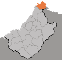 Map of Chagang showing the location of Chunggang | |
| Country | North Korea |
| Province | Chagang Province |
| Administrative divisions | 1 ŭp, 1 workers' district, 8 ri |
| Area | |
| • Total | 620 km2 (240 sq mi) |
| Population (1991 est.) | |
| • Total | 33,000 |
Chunggang County is a kun, or county, in northern Chagang province, North Korea. It was originally part of Huchang county in Ryanggang, and for that reason older sources still identify it as being part of Huchang. The county seat was originally known as Chunggangjin (중강진), but is now known as Chunggang ŭp. Chunggang looks across the Yalu River at China, and borders Ryanggang province to the south.
The Chunggang Revolutionary Site is associated with Kim Hyong-jik.[1]
It has been reported that an Intermediate-range ballistic missile base was constructed in Chunggang in the early 1990s, and that its missiles are targeted at Okinawa.[2]
Administrative divisions
Chunggang County is divided into 1 ŭp (town), 1 rodongjagu (workers' district) and 8 ri (villages):
|
|
Climate
The climate of Chunggang is continental. On January 12, 1933, a temperature of -43 °C was recorded at Chunggangjin.[3] The average January temperature is -16.0 °C, with temperatures rising to a July average of 22.5 °C.
| Climate data for Chunggang, North Korea | |||||||||||||
|---|---|---|---|---|---|---|---|---|---|---|---|---|---|
| Month | Jan | Feb | Mar | Apr | May | Jun | Jul | Aug | Sep | Oct | Nov | Dec | Year |
| Record high °C (°F) | 6.0 (42.8) |
12.0 (53.6) |
21.5 (70.7) |
31.0 (87.8) |
34.0 (93.2) |
36.1 (97) |
40.2 (104.4) |
39.0 (102.2) |
31.0 (87.8) |
28.1 (82.6) |
19.0 (66.2) |
10.2 (50.4) |
40.2 (104.4) |
| Average high °C (°F) | −12.3 (9.9) |
−6.2 (20.8) |
2.8 (37) |
13.9 (57) |
20.9 (69.6) |
25.9 (78.6) |
29.0 (84.2) |
28.3 (82.9) |
22.1 (71.8) |
15.0 (59) |
3.5 (38.3) |
−8.6 (16.5) |
11.2 (52.2) |
| Daily mean °C (°F) | −19.5 (−3.1) |
−14.5 (5.9) |
−3.4 (25.9) |
7.0 (44.6) |
14.0 (57.2) |
18.8 (65.8) |
22.6 (72.7) |
21.7 (71.1) |
14.3 (57.7) |
6.5 (43.7) |
−3.3 (26.1) |
−15.0 (5) |
4.1 (39.4) |
| Average low °C (°F) | −28.8 (−19.8) |
−24.3 (−11.7) |
−10.8 (12.6) |
−0.3 (31.5) |
6.7 (44.1) |
12.7 (54.9) |
17.7 (63.9) |
17.0 (62.6) |
8.5 (47.3) |
0.1 (32.2) |
−8.8 (16.2) |
−22.3 (−8.1) |
−2.7 (27.1) |
| Record low °C (°F) | −37.2 (−35) |
−36.1 (−33) |
−32.2 (−26) |
−12.8 (9) |
−5.2 (22.6) |
4.7 (40.5) |
9.0 (48.2) |
4.1 (39.4) |
−2.5 (27.5) |
−13.2 (8.2) |
−30.0 (−22) |
−36.1 (−33) |
−37.2 (−35) |
| Average precipitation mm (inches) | 10.4 (0.409) |
10.5 (0.413) |
23.1 (0.909) |
43.3 (1.705) |
77.6 (3.055) |
114.5 (4.508) |
193.5 (7.618) |
184.7 (7.272) |
77.1 (3.035) |
41.7 (1.642) |
29.5 (1.161) |
18.4 (0.724) |
824.3 (32.453) |
| Average precipitation days (≥ 0.1 mm) | 3 | 2 | 5 | 7 | 11 | 12 | 14 | 12 | 9 | 7 | 6 | 5 | 93 |
| Average relative humidity (%) | 80 | 76 | 67 | 60 | 64 | 73 | 80 | 81 | 80 | 72 | 73 | 78 | 74 |
| Mean monthly sunshine hours | 151 | 158 | 188 | 184 | 192 | 168 | 155 | 149 | 148 | 169 | 130 | 128 | 1,920 |
| Source #1: Deutscher Wetterdienst (sun, 1961–1990)[4][5][lower-alpha 1] | |||||||||||||
| Source #2: Meteo Climat (extremes, 1915–present)[6] | |||||||||||||
Notes
- ↑ Station ID for Chunggang is 47014 Use this station ID to locate the sunshine duration
References
- ↑ "Junggang Revolutionary Site". KCNA. 9 July 2007. Archived from the original on 12 October 2014.
- ↑ "Chunggang-up". GlobalSecurity.org. Retrieved 2006-11-11.
- ↑ Bukhan Yeonguso (1983), p. 49.
- ↑ "Klimatafel von Chunggang / Korea (Nordkorea)" (PDF). Baseline climate means (1961-1990) from stations all over the world (in German). Deutscher Wetterdienst. Retrieved 6 November 2016.
- ↑ "Station 47014 Chunggang". Global station data 1961–1990—Sunshine Duration. Deutscher Wetterdienst. Retrieved 6 November 2016.
- ↑ "Station Chunggang" (in French). Meteo Climat. Retrieved 6 October 2018.
See also
References
- Bukhan Yeonguso (1983). 북한총람 [Bukhan chongram]. Seoul: Author.
External links
- Climatological data
- (in Korean) In Korean language online encyclopedias: