Chouzy-sur-Cisse
| Chouzy-sur-Cisse | ||
|---|---|---|
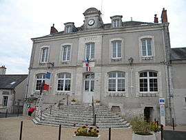 Town hall | ||
| ||
 Chouzy-sur-Cisse Location within Centre-Val de Loire region  Chouzy-sur-Cisse | ||
| Coordinates: 47°31′34″N 1°14′53″E / 47.5261°N 1.2481°ECoordinates: 47°31′34″N 1°14′53″E / 47.5261°N 1.2481°E | ||
| Country | France | |
| Region | Centre-Val de Loire | |
| Department | Loir-et-Cher | |
| Arrondissement | Blois | |
| Canton | Onzain | |
| Area1 | 22.43 km2 (8.66 sq mi) | |
| Population (2013)2 | 1,962 | |
| • Density | 87/km2 (230/sq mi) | |
| Time zone | UTC+1 (CET) | |
| • Summer (DST) | UTC+2 (CEST) | |
| INSEE/Postal code | 41055 /41150 | |
| Elevation |
61–115 m (200–377 ft) (avg. 102 m or 335 ft) | |
|
1 French Land Register data, which excludes lakes, ponds, glaciers > 1 km2 (0.386 sq mi or 247 acres) and river estuaries. 2 Population without double counting: residents of multiple communes (e.g., students and military personnel) only counted once. | ||
.svg.png)
Chouzy-sur-Cisse is a former commune in the Loir-et-Cher department of central France. On January 1, 2017, it was merged into the new commune Valloire-sur-Cisse.[1]
Population
| Historical population | ||
|---|---|---|
| Year | Pop. | ±% |
| 1793 | 973 | — |
| 1806 | 1,013 | +4.1% |
| 1821 | 1,092 | +7.8% |
| 1831 | 129 | −88.2% |
| 1841 | 1,390 | +977.5% |
| 1951 | 1,469 | +5.7% |
| 1961 | 1,442 | −1.8% |
| 1872 | 1,428 | −1.0% |
| 1881 | 1,454 | +1.8% |
| 1891 | 1,469 | +1.0% |
| 1901 | 1,405 | −4.4% |
| 1911 | 1,296 | −7.8% |
| 1921 | 1,105 | −14.7% |
| 1931 | 1,034 | −6.4% |
| 1946 | 1,023 | −1.1% |
| 1954 | 1,014 | −0.9% |
| 1962 | 1,129 | +11.3% |
| 1968 | 1,159 | +2.7% |
| 1975 | 1,261 | +8.8% |
| 1982 | 1,476 | +17.0% |
| 1990 | 1,619 | +9.7% |
| 1999 | 1,866 | +15.3% |
| 2008 | 1,839 | −1.4% |
| 2013 | 1,962 | +6.7% |
See also
References
- ↑ Arrêté préfectoral 4 June 2016 (in French)
| Wikimedia Commons has media related to Chouzy-sur-Cisse. |
This article is issued from
Wikipedia.
The text is licensed under Creative Commons - Attribution - Sharealike.
Additional terms may apply for the media files.