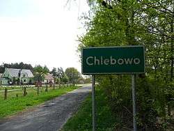
Chlebowo, Lubusz Voivodeship
| Chlebowo | |
|---|---|
| Village | |
 | |
 Chlebowo | |
| Coordinates: 52°2′12″N 14°52′8″E / 52.03667°N 14.86889°E | |
| Country |
|
| Voivodeship | Lubusz |
| County | Krosno Odrzańskie |
| Gmina | Gmina Gubin |
Chlebowo [xlɛˈbɔvɔ] (Lower Sorbian: Namašklěb, German: Niemaschkleba, 1935-1945: Lindenhain, 1945-1953: Niemaszchleba) is a village in the administrative district of Gmina Gubin, within Krosno Odrzańskie County, Lubusz Voivodeship, in western Poland, close to the German border.[1]
Geography
It lies on the northeastern rim of the historic Lower Lusatia region, approximately 15 kilometres (9 mi) north-east of Gubin, 16 km (10 mi) west of Krosno Odrzańskie, and 45 km (28 mi) west of Zielona Góra.
History

The name of the village is possibly derived from Slavic chleb ("bread"). It was first documented as Schwchleb and Nemascleb in the 1295 Liber fundationis episcopatus Vratislaviensis document by the Bishops of Wrocław. The settlement then was located at the eastern border of the German March of Lusatia, close to the Silesian Duchy of Głogów.
The area was part of the Bohemian crown lands before it passed to the Electorate of Saxony according to the 1635 Peace of Prague. Ceded to the Kingdom of Prussia, it was incorporated into the Province of Brandenburg in 1815. Under Nazi German rule, the village's name was Germanised to Lindenhain in 1937; after it fell to the Republic of Poland according to the 1945 Potsdam Agreement (see Territorial changes of Poland after World War II), it was renamed Niemaszchleba and again in 1953 Chlebowo.