Chihuahua Municipality
| Chihuahua | |
|---|---|
| Municipality | |
 | |
 Municipality of Chihuahua | |
|
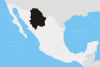
Chihuahua Location in Mexico | |
| Coordinates: 28°38′07″N 106°05′20″W / 28.63528°N 106.08889°WCoordinates: 28°38′07″N 106°05′20″W / 28.63528°N 106.08889°W | |
| Country |
|
| State | Chihuahua |
| Municipal seat | Chihuahua, Chih. |
| Municipality created | 7 August 1821 |
| Government | |
| • Mayor of Chihuahua | María Eugenia Campos Galván (PAN) |
| Area | |
| • Total | 9,219.30 km2 (3,559.59 sq mi) |
| Elevation | 1,440 m (4,720 ft) |
| Population (2010) | |
| • Total | 819,543 |
| Postal code | 31000 |
| Area code(s) | 614 |
| Website | http://www.municipiochihuahua.gob.mx |
Chihuahua is one of the 67 municipalities of Chihuahua, in northern Mexico. The municipal seat is the city of Chihuahua which is also the capital of Chihuahua State.
As of 2010, the municipality had a total population of 819,543,[1] up from 758,791 as of 2005. It covers an area of 9219.30 km².
As of 2010, the city of Chihuahua had a population of 809,232,[1] up from 748,551 as of 2005. Other than the city of Chihuahua, the municipality had 888 localities, the largest of which (with 2010 populations in parentheses) was: El Sauz (1,499), classified as rural.[1]
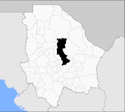
Geography

Principal locations in Chihuahua Municipality.
The municipality includes 888 localities, the population of the principal ones are:
| Locality | Population |
| Total of Municipality | 758,791 |
| Chihuahua | 748,518 |
| El Sauz | 1,541 |
| Nuevo Delicias | 722 |
| San Isidro, Los Hoyos | 628 |
| La Casita | 333 |
| Nuevo Sacramento | 322 |
| Labor de Terrazas | 313 |
| Estación Terrazas | 306 |
| El Charco | 263 |
| Sacramento | 229 |
| Colonia Soto | 195 |
| Ciénega de Ortiz | 53 |
References
- 1 2 3 "Chihuahua". Catálogo de Localidades. Secretaría de Desarrollo Social (SEDESOL). Retrieved 23 April 2014.
- Municipio de Chihuahua Enciclopedia de los municipios de México, INAFED
This article is issued from
Wikipedia.
The text is licensed under Creative Commons - Attribution - Sharealike.
Additional terms may apply for the media files.