Chignik, Alaska
| Chignik | |
|---|---|
| City | |
 Chignik from above | |
 Chignik Location in Alaska | |
| Coordinates: 56°17′54″N 158°24′16″W / 56.29833°N 158.40444°WCoordinates: 56°17′54″N 158°24′16″W / 56.29833°N 158.40444°W | |
| Country | United States |
| State | Alaska |
| Borough | Lake and Peninsula |
| Incorporated | May 16, 1983[1] |
| Government | |
| • Mayor | Alana Anderson |
| • State senator | Lyman Hoffman (D) |
| • State rep. | Bryce Edgmon (D) |
| Area[2] | |
| • Total | 15.87 sq mi (41.11 km2) |
| • Land | 11.39 sq mi (29.49 km2) |
| • Water | 4.49 sq mi (11.62 km2) |
| Elevation | 0 ft (0 m) |
| Population (2010) | |
| • Total | 91 |
| • Estimate (2016)[3] | 87 |
| • Density | 5.48/sq mi (2.12/km2) |
| Time zone | UTC-9 (Alaska (AKST)) |
| • Summer (DST) | UTC-8 (AKDT) |
| ZIP codes | 99548, 99564 |
| Area code | 907 |
| FIPS code | 02-13550 |
| GNIS feature ID | 1400269 |
Chignik (Alutiiq: Cirniq) is a city in Lake and Peninsula Borough, Alaska, United States. It is two hundred and fifty miles southwest of Kodiak. At the 2010 census the population was 91, up from 79 in 2000.
History
On April 17, 1911, a gale blew ashore numerous ships such as the Benjamin F. Packard, the Star of Alaska, and the Jabez Howes, a three-masted, full-rigged ship owned by the Columbia River Packers Association and used as a cannery tender.
A young special education teacher named Candice Berner was killed by timber wolves in this area on March 8, 2010.[4]
Geography
Chignik is located at 56°17′54″N 158°24′16″W / 56.29833°N 158.40444°W (56.298297, −158.404402).[5]
According to the United States Census Bureau, the city has a total area of 16 square miles (41 km2), 12 sq mi (31 km2) of it is land and 4 sq mi (10 km2) is water.
Demographics
| Historical population | |||
|---|---|---|---|
| Census | Pop. | %± | |
| 1940 | 224 | — | |
| 1950 | 253 | 12.9% | |
| 1960 | 99 | −60.9% | |
| 1970 | 83 | −16.2% | |
| 1980 | 178 | 114.5% | |
| 1990 | 188 | 5.6% | |
| 2000 | 79 | −58.0% | |
| 2010 | 91 | 15.2% | |
| Est. 2016 | 87 | [3] | −4.4% |
| U.S. Decennial Census[6] | |||
Chignik first appeared on the 1940 U.S. Census as an unincorporated village, although it was preceded by "Chignik Bay", which may have included the village and canneries in the surrounding area, including Chignik Lagoon. Chignik Bay reported a population of 193 in 1890[7] (which was majority Asian (121), with 66 White residents, 5 Native Alaskans & 1 Other). It did not report again until 1910 when it had a total of 566 residents, which made it the 13th largest community in the territory of Alaska. This was the last time it appeared on the census until Chignik in 1940.
As of the census[8] of 2000, there were 79 people, 29 households, and 20 families residing in the city. The population density was 7 per square mile (3/km²). There were 80 housing units at an average density of 7 per square mile (3/km²). The racial makeup of the city was 32% white, 61% Native American, 3% Asian, 3% Pacific Islander, 1% from other races, and 1% from two or more races. 1% of the population were Hispanic or Latino of any race.
There were 29 households; 11 had children under the age of 18 living with them, 19 were married couples living together, 2 had a female householder with no husband present, and 8 were non-families. Seven households were individuals and 10 consisted of a sole occupant 65 years of age or older. The average household size was 2.7 and the average family size was 3.3.
In the city, the age distribution of the population shows 25% under the age of 18, 14% from 18 to 24, 33% from 25 to 44, 23% from 45 to 64, and 5% who were 65 years of age or older. The median age was 36 years. For every 100 females, there were 114 males. For every 100 females age 18 and over, there were 111 males.
The median income for a household in the city was $34,000, and the median income for a family was $51,000. The male and female median incomes were equal, at $31,250. The per capita income for Chignik was $16,000. 5% of the population lived below the poverty line; none were under 18 or over 64 years old.
Notable people
- Benny Benson, the famous designer of the Alaskan Flag, was born in Chignik.
Climate
| Climate data for Chignik, Alaska | |||||||||||||
|---|---|---|---|---|---|---|---|---|---|---|---|---|---|
| Month | Jan | Feb | Mar | Apr | May | Jun | Jul | Aug | Sep | Oct | Nov | Dec | Year |
| Average high °F (°C) | 31.1 (−0.5) |
32.5 (0.3) |
34.7 (1.5) |
39.5 (4.2) |
46.4 (8) |
54.9 (12.7) |
61.0 (16.1) |
60.8 (16) |
54.9 (12.7) |
45.4 (7.4) |
38.4 (3.6) |
34.0 (1.1) |
44.5 (6.9) |
| Average low °F (°C) | 19.8 (−6.8) |
21.1 (−6.1) |
23.3 (−4.8) |
28.1 (−2.2) |
34.9 (1.6) |
41.2 (5.1) |
46.1 (7.8) |
46.6 (8.1) |
41.3 (5.2) |
34.0 (1.1) |
27.7 (−2.4) |
23.6 (−4.7) |
32.3 (0.2) |
| Average rainfall inches (mm) | 5.88 (149.4) |
7.61 (193.3) |
6.90 (175.3) |
4.87 (123.7) |
6.74 (171.2) |
6.02 (152.9) |
4.31 (109.5) |
5.08 (129) |
9.74 (247.4) |
8.83 (224.3) |
10.06 (255.5) |
7.22 (183.4) |
83.27 (2,115.1) |
| Average snowfall inches (cm) | 7.5 (19.1) |
14.6 (37.1) |
6.5 (16.5) |
6.7 (17) |
0.9 (2.3) |
0 (0) |
0 (0) |
0 (0) |
0 (0) |
0.5 (1.3) |
5.2 (13.2) |
4.5 (11.4) |
46.3 (117.6) |
| Source: [9] | |||||||||||||
References
- ↑ 1996 Alaska Municipal Officials Directory. Juneau: Alaska Municipal League/Alaska Department of Community and Regional Affairs. January 1996. p. 38.
- ↑ "2016 U.S. Gazetteer Files". United States Census Bureau. Retrieved Jun 22, 2017.
- 1 2 "Population and Housing Unit Estimates". Retrieved June 9, 2017.
- ↑ https://www.sott.net/article/285776-Teacher-Candice-Berner-mauled-to-death-by-wolves-in-Alaska
- ↑ "US Gazetteer files: 2010, 2000, and 1990". United States Census Bureau. 2011-02-12. Retrieved 2011-04-23.
- ↑ "Census of Population and Housing". Census.gov. Archived from the original on 12 May 2015. Retrieved June 4, 2015.
- ↑ http://www2.census.gov/prod2/decennial/documents/1890a_v8-01.pdf
- ↑ "American FactFinder". United States Census Bureau. Archived from the original on 11 September 2013. Retrieved 2008-01-31.
- ↑ "CHIGNIK, ALASKA - Period of Record Monthly Climate Summary 9/1/1967 to 5/31/1978". Western Regional Climate Center. Retrieved 20 August 2010.
External links
- 2005 Chignik management area annual management report / by Mark A. Stichert. Hosted by the Alaska State Publications Program.
Municipalities and communities of Lake and Peninsula Borough, Alaska, United States | ||
|---|---|---|
| Cities | 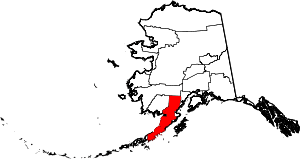 | |
| CDPs | ||
| Ghost town | ||