Chibougamau
| Chibougamau | |||
|---|---|---|---|
| City | |||
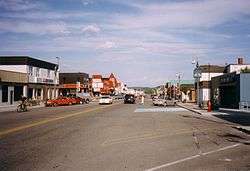 Chibougamau main street | |||
| |||
 Chibougamau Location in Quebec, Canada | |||
| Coordinates (650, 3e Rue[1]): 49°55′N 74°22′W / 49.917°N 74.367°WCoordinates: 49°55′N 74°22′W / 49.917°N 74.367°W[2] | |||
| Country |
| ||
| Province |
| ||
| Region | Nord-du-Québec | ||
| RCM | None | ||
| Settled | 1952 | ||
| Constituted | November 8, 1952 | ||
| Government[1] | |||
| • Mayor | Manon Cyr | ||
| • Federal riding | Abitibi—Baie-James—Nunavik—Eeyou | ||
| • Prov. riding | Ungava | ||
| Area[1][3] | |||
| • Total | 1,027.80 km2 (396.84 sq mi) | ||
| • Land | 699.31 km2 (270.01 sq mi) | ||
| Population (2011)[3] | |||
| • Total | 7,541 | ||
| • Density | 10.8/km2 (28/sq mi) | ||
| • Change (2006–11) |
| ||
| • Dwellings | 3,474 | ||
| Time zone | UTC−5 (EST) | ||
| • Summer (DST) | UTC−4 (EDT) | ||
| Postal code(s) | G8P | ||
| Area code(s) | 418 and 581 | ||
| Climate | Dfc | ||
| Website |
www | ||

.svg.png)
Chibougamau is a town in central Quebec, Canada, located on Lake Gilman. It has a population of 7,541 people (Canada 2011 Census). Chibougamau is completely surrounded by, but not part of, the Municipality of Baie-James.
Due to its remoteness from Lac Saint-Jean (over 200 km (124 mi) south-east) and Abitibi-Témiscamingue (over 250 km (155 mi) south-west) areas, Chibougamau provides services for a few smaller communities surrounding it (Mistissini, Oujé-Bougoumou and Chapais) and for the regional resource-based industries. Despite Chibougamau's remoteness, it is only about as far north as Winnipeg.
Nearby are Lake Aux Dorés and the vast Chibougamau Lake, after which the town was named. Chibougamau means "Gathering place" in Cree. The neighbouring Cree village of Oujé-Bougoumou has the same name with a more traditional Cree spelling.
The area surrounding Lake Gilman is Obalski Park. Its amenities include a beach, pier, picnic tables, cabins, among others. The many trails allow for hiking, cycling, cross-country skiing, or even snowmobiling through the park's boreal forest.
Access to the town is by Route 167 from Lac Saint-Jean and by Route 113 from Lebel-sur-Quevillon. Chibougamau's airport is along Route 113, about halfway to Chapais.
History
The area has long been part of the Cree territory. It was in the early 17th century that French explorers and traders, including Charles Albanel in 1671, came to the Lake Chibougamau area. However, no permanent European settlements were established at that time.
Only in the late 19th Century did the area attract the interest of mining prospectors. When gold was discovered in 1903, there were periods of intense exploration. Due to difficulty of access,[4] no lasting development took place at that time. Not until 1949 was copper first exploited,[5] with the opening of a multi-metallic mine in the area, and a permanent community was established in 1952.[5] Chibougamau started out as a company town but soon after, in 1954, it was incorporated as a municipality. Many mines have exploited the area since. While still thought of as a mining town, Chibougamau is now also the centre of a large logging and sawmill[5] industry.
From 1962 to 1988s, the Royal Canadian Air Force operated CFS Chibougamau, a radar station in Chibougamau that was part of the Pinetree Line. The complex has now been transformed into a golf complex and an office for a mining company.
Since December 2001, the mayor of Chibougamau is also part of the municipal council of Municipality of Baie-James.
The city is home to an annual "Folies frettes" festival ("Cold Follies") and a snowmobile rally.[5]
Demographics
| Historical populations | ||
|---|---|---|
| Year | Pop. | ±% |
| 1991 | 8,855 | — |
| 1996 | 8,664 | −2.2% |
| 2001 | 7,922 | −8.6% |
| 2006 | 7,563 | −4.5% |
| 2011 | 7,541 | −0.3% |
| [6] | ||
| Canada 2006 Census | Population | % of Total Population | |
|---|---|---|---|
| Visible minority group Source:[7] |
Chinese | 35 | 0.5 |
| Black | 15 | 0.2 | |
| Latin American | 15 | 0.2 | |
| Other visible minority | 5 | 0 | |
| Total visible minority population | 70 | 0.9 | |
| Aboriginal group Source:[7] | First Nations | 50 | 0.7 |
| Métis | 85 | 1.1 | |
| Inuit | 0 | 0 | |
| Total Aboriginal population | 140 | 1.9 | |
| White | 7,320 | 97.2 | |
| Total population | 7,530 | 100 | |
Private dwellings occupied by usual residents: 3222 (total dwellings: 3474)
First language:
- English : 2%
- French : 97%
- Both English and French : 0.1%
- Others : 1%
Education
French-language schools in Chibougamau, past and present, are:
- École Bon-Pasteur
- École Vatican II
- École Notre-Dame-du-Rosaire
- École La Porte-du-Nord
- École Vinette (closed 1994)
- Centre de formation professionnelle de la Baie-James
- Centre d'études collégiales Chibougamau
The English-language school is MacLean Memorial School , formerly Chibougamau Protestant School. There also used to be a Catholic English-language school called Holy Family School.
Climate
Chibougamau has a subarctic climate (Köppen climate classification Dfc), despite being located just south of 50 degrees latitude. Winters are long, cold, and snowy with a January high of −13.5 °C (7.7 °F) and a low of −24.2 °C (−11.6 °F). Summers are warm though short with a July high of 22.2 °C (72.0 °F) and a low of 10.5 °C (50.9 °F). Overall precipitation is high for a subarctic climate with an average annual precipitation of 996 millimetres (39 in) and 313 centimetres (123 in) of snow per season. Precipitation is significant year round though February through April are drier.[8]
| Climate data for Chapais (1981−2010) (49°47′N 074°51′W / 49.783°N 74.850°W) approximately 37 km (23 mi) southwest | |||||||||||||
|---|---|---|---|---|---|---|---|---|---|---|---|---|---|
| Month | Jan | Feb | Mar | Apr | May | Jun | Jul | Aug | Sep | Oct | Nov | Dec | Year |
| Record high °C (°F) | 8.5 (47.3) |
9.0 (48.2) |
16.0 (60.8) |
28.0 (82.4) |
31.5 (88.7) |
34.5 (94.1) |
35.0 (95) |
33.3 (91.9) |
29.0 (84.2) |
24.4 (75.9) |
17.8 (64) |
11.0 (51.8) |
35.0 (95) |
| Average high °C (°F) | −13.5 (7.7) |
−10.3 (13.5) |
−3.3 (26.1) |
5.2 (41.4) |
13.9 (57) |
20.0 (68) |
22.2 (72) |
20.5 (68.9) |
14.2 (57.6) |
6.7 (44.1) |
−1.9 (28.6) |
−9.3 (15.3) |
5.4 (41.7) |
| Daily mean °C (°F) | −18.8 (−1.8) |
−16.2 (2.8) |
−9.5 (14.9) |
−0.3 (31.5) |
8.1 (46.6) |
14.1 (57.4) |
16.4 (61.5) |
15.0 (59) |
9.7 (49.5) |
3.1 (37.6) |
−5.2 (22.6) |
−13.6 (7.5) |
0.2 (32.4) |
| Average low °C (°F) | −24.2 (−11.6) |
−22.2 (−8) |
−15.5 (4.1) |
−5.7 (21.7) |
2.2 (36) |
8.2 (46.8) |
10.5 (50.9) |
9.5 (49.1) |
5.2 (41.4) |
−0.5 (31.1) |
−8.5 (16.7) |
−18 (0) |
−4.9 (23.2) |
| Record low °C (°F) | −43.3 (−45.9) |
−42.8 (−45) |
−38 (−36) |
−27.2 (−17) |
−16.1 (3) |
−5.6 (21.9) |
−0.6 (30.9) |
−2.2 (28) |
−6 (21) |
−13.3 (8.1) |
−30 (−22) |
−42 (−44) |
−43.3 (−45.9) |
| Average precipitation mm (inches) | 61.9 (2.437) |
39.4 (1.551) |
50.3 (1.98) |
56.6 (2.228) |
82.4 (3.244) |
100.1 (3.941) |
124.3 (4.894) |
100.2 (3.945) |
129.7 (5.106) |
93.9 (3.697) |
93.2 (3.669) |
63.5 (2.5) |
995.5 (39.192) |
| Average rainfall mm (inches) | 3.2 (0.126) |
2.4 (0.094) |
8.8 (0.346) |
28.7 (1.13) |
75.5 (2.972) |
100.1 (3.941) |
124.3 (4.894) |
100.2 (3.945) |
128.6 (5.063) |
70.9 (2.791) |
36.7 (1.445) |
5.0 (0.197) |
684.4 (26.944) |
| Average snowfall cm (inches) | 58.8 (23.15) |
37.0 (14.57) |
41.6 (16.38) |
29.5 (11.61) |
6.9 (2.72) |
0.0 (0) |
0.0 (0) |
0.0 (0) |
1.2 (0.47) |
23.0 (9.06) |
56.5 (22.24) |
58.5 (23.03) |
313 (123.23) |
| Average precipitation days (≥ 0.2 mm) | 18.1 | 13.6 | 12.1 | 12.3 | 14.8 | 16.3 | 17.4 | 17.1 | 20.2 | 19.8 | 19.9 | 19.3 | 200.9 |
| Average rainy days (≥ 0.2 mm) | 0.55 | 1.1 | 2.4 | 6.7 | 13.6 | 16.3 | 17.4 | 17.1 | 20.1 | 14.5 | 6.1 | 1.3 | 117.15 |
| Average snowy days (≥ 0.2 cm) | 18.0 | 12.9 | 10.4 | 7.9 | 2.5 | 0.0 | 0.0 | 0.0 | 0.47 | 7.4 | 16.1 | 18.5 | 94.17 |
| Mean monthly sunshine hours | 90 | 122 | 170 | 164 | 202 | 234 | 233 | 208 | 113 | 84 | 46 | 66 | 1,732 |
| Source #1: Environment Canada[8] | |||||||||||||
| Source #2: The Weather Network(sunshine data only).[9] | |||||||||||||
See also
- Chibougamau Lake, a waterbody
- Dorés Lake (Chibougamau River), a waterbody
- Courtois Lake (Jamésie), a waterbody
- Chibougamau River, a watercouse
- Chibougamau/Chapais Airport
- Jamésie
- Nord-du-Québec, an administrative region in Quebec
- List of communities in Quebec
- Nord-du-Québec
References
Notes
- 1 2 3 Geographic code 99025 in the official Répertoire des municipalités (in French)
- ↑ Reference number 13148 of the Commission de toponymie du Québec (in French)
- 1 2 "(Code 2499025) Census Profile". 2011 census. Statistics Canada. 2012.
- ↑ St.-Hilaire, Marc. "Chibougamuau", in The Canadian Encyclopedia (Edmonton: Hurtig Publishing, 1988), Volume 1, p.407.
- 1 2 3 4 St.-Hilaire, p.407.
- ↑ Statistics Canada: 1996, 2001, 2006, 2011 census
- 1 2 "Pickering, Ontario (City) Census Subdivision". Community Profiles, Canada 2006 Census. Statistics Canada.
- 1 2 "Chapais 2". Canadian Climate Normals 1981–2010. Environment Canada. Retrieved October 6, 2013.
- ↑ Statistics, Accessed 10 March 2012.
Sources
- St.-Hilaire, Marc. "Chibougamuau", in The Canadian Encyclopedia, Volume 1, p. 407. Edmonton: Hurtig Publishing, 1988.
- Allen, H. D. (May 30, 1965). "The Call of the North". Teachers' Magazine. Provincial Association of Protestant Teachers of Quebec. XLV (227): 8–18.
External links
| Wikimedia Commons has media related to Chibougamau. |

- Official site
- Municipality of Baie-James
| Regional county municipalities and equivalent territories |
|
|---|---|
| Municipalities | |