Chesterfield Township, Fulton County, Ohio
| Chesterfield Township, Fulton County, Ohio | |
|---|---|
| Township | |
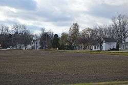 Houses at Oakshade | |
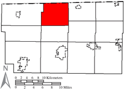 Location of Chesterfield Township in Fulton County | |
| Coordinates: 41°40′46″N 84°9′49″W / 41.67944°N 84.16361°WCoordinates: 41°40′46″N 84°9′49″W / 41.67944°N 84.16361°W | |
| Country | United States |
| State | Ohio |
| County | Fulton |
| Area | |
| • Total | 29.1 sq mi (75.4 km2) |
| • Land | 29.0 sq mi (75.1 km2) |
| • Water | 0.1 sq mi (0.3 km2) |
| Elevation[1] | 810 ft (247 m) |
| Population (2010) | |
| • Total | 1,012 |
| • Density | 35/sq mi (13.5/km2) |
| Time zone | UTC-5 (Eastern (EST)) |
| • Summer (DST) | UTC-4 (EDT) |
| FIPS code | 39-14072[2] |
| GNIS feature ID | 1086121[1] |
Chesterfield Township is one of the twelve townships of Fulton County, Ohio, United States. The 2010 census found 1,012 people in the township.[3]
Geography
Located in the northern part of the county along the Michigan border, it borders the following townships:
- Seneca Township, Lenawee County, Michigan - north
- Fairfield Township, Lenawee County, Michigan - northeast corner
- Royalton Township - east
- Pike Township - southeast
- Dover Township - south
- Franklin Township - southwest corner
- Gorham Township - west
The unincorporated communities of Advance, Denson, Inlet and Oakshade are located in Chesterfield Township.
Name and history
Chesterfield Township was organized in 1837, and named for Chesterfield Clemons, a pioneer settler.[4] It is the only Chesterfield Township statewide.[5]
Government
The township is governed by a three-member board of trustees, who are elected in November of odd-numbered years to a four-year term beginning on the following January 1. Two are elected in the year after the presidential election and one is elected in the year before it. There is also an elected township fiscal officer,[6] who serves a four-year term beginning on April 1 of the year after the election, which is held in November of the year before the presidential election. Vacancies in the fiscal officership or on the board of trustees are filled by the remaining trustees.
Attractions
The Tiffin River runs through the northwest portion of the township.
The Advance area features a private 115-acre (47 ha) campground with 800 campsites and a small golf course.[7][8][9]
Public services
Public schools
Students from the township are served by the following public local school district:[10]
Mail is delivered in the township by the following U.S. Post Office locations:[11]
- Fayette, Ohio 43521
- Lyons, Ohio 43533
- Wauseon, Ohio 43567
Telephone
Most of the township is within the Chesterfield telephone exchange, which is served by Windstream Ohio, with telephone numbers using the following Numbering Plan Code:[12]
- 419-452
A northwestern portion is served by the Lyons telephone exchange, which is delivered by UTO (United Telephone Company of Ohio,) doing business as CenturyLink, with the following codes:
- 419-390
- 419-923
The southern section of the township is within the Wauseon exchange, again served by UTO, DBA CenturyLink:
- 419-330
- 419-335
- 419-337
- 419-388
- 419-404
- 419-583
- 419-590
Electric
Toledo Edison and Midwest Energy Cooperative serve the township with electricity.[13]
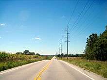
Highways
Fire and EMS
Morenci Area EMS in Morenci, Michigan serves most of the township,[14] with Lyons Fire/EMS serving an eastern portion, and Wauseon Fire/EMS serving a small area in the south.[15]
References
- 1 2 "US Board on Geographic Names". United States Geological Survey. 2007-10-25. Retrieved 2008-01-31.
- ↑ "American FactFinder". United States Census Bureau. Archived from the original on 2013-09-11. Retrieved 2008-01-31.
- ↑ Fulton County 2014 Population Estimates For Cities, Villages, and Townships Ohio State University, published May 2015. Accessed 29 March 2016.
- ↑ Aldrich, Lewis Cass (1888). History of Henry and Fulton counties, Ohio. D. Mason & Co. p. 444.
- ↑ "Detailed map of Ohio" (PDF). United States Census Bureau. 2000. Retrieved 2007-02-16.
- ↑ §503.24, §505.01, and §507.01 of the Ohio Revised Code. Accessed 4/30/2009.
- ↑ Sunny's Campground home page
- ↑ Google Maps, Old Pines Golf Club
- ↑ Sunny's Shady Recreation Area
- ↑ School District Boundary Maps GreatSchools.org. Retrieved 29 March 2016
- ↑ Zip Map: Fulton County ZipMap.net
- ↑ PUCO: Ohio Telephone Exchange Areas puco.gov
- ↑ PUCO: Electric Service Areas of Ohio Archived 2016-04-06 at the Wayback Machine. puco.gov
- ↑ Morenci Area EMS CityofMorenci.org
- ↑ Fulton County Fire Districts (Map). Fulton County, Ohio. Retrieved 9 April 2016.
External links
Municipalities and communities of Fulton County, Ohio, United States | ||
|---|---|---|
| City | 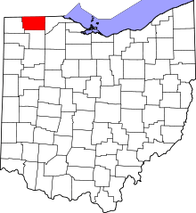 | |
| Villages | ||
| Townships | ||
| CDPs | ||
| Unincorporated communities | ||
| Ghost towns | ||
| Footnotes | ‡This populated place also has portions in an adjacent county or counties | |