Chernozemelsky District
| Chernozemelsky District Черноземельский район (Russian) Хар Һазра район (Kalmyk) | |
|---|---|
.svg.png) Location of Chernozemelsky District in the Republic of Kalmykia | |
| Coordinates: 45°20′N 46°02′E / 45.333°N 46.033°ECoordinates: 45°20′N 46°02′E / 45.333°N 46.033°E | |
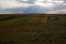 Near Village Adyk, Chernozemelsky District | |
| Location | |
| Country | Russia |
| Federal subject | Republic of Kalmykia[1] |
| Administrative structure (as of June 2011) | |
| Administrative center | settlement of Komsomolsky[1] |
| Administrative divisions:[1] | |
| Rural administrations | 8 |
| Inhabited localities:[1] | |
| Rural localities | 35 |
| Municipal structure (as of March 2015) | |
| Municipally incorporated as | Chernozemelsky Municipal District[2] |
| Municipal divisions:[2] | |
| Urban settlements | 0 |
| Rural settlements | 8 |
| Statistics | |
| Area (June 2011) | 14,191.68 km2 (5,479.44 sq mi)[1] |
| Population (2010 Census) | 13,258 inhabitants[3] |
| • Urban | 0% |
| • Rural | 100% |
| Density | 0.93/km2 (2.4/sq mi)[4] |
| Time zone | MSK (UTC+03:00)[5] |
| Established | 1951[1] |
| Official website | |
| Chernozemelsky District on WikiCommons | |
| 2010 Census | 13,258[3] |
|---|---|
| 2002 Census | 12,990[6] |
| 1989 Census | 16,840[7] |
| 1979 Census | 14,831[8] |
Chernozemelsky District (Russian: Черноземе́льский райо́н, [t͡ɕʲɪrnɐzʲɪˈmʲelskɪj raˈjon]; Kalmyk: Хар Һазра район, translit. Xar Hazra rayon, [xɑr.hɑˈzɑrə rɑˈjɔn]) is an administrative[1] and municipal[2] district (raion), one of the thirteen in the Republic of Kalmykia, Russia. It is located in the southeast of the republic. The area of the district is 14,191.68 square kilometers (5,479.44 sq mi).[1] Its administrative center is the rural locality (a settlement) of Komsomolsky.[1] As of the 2010 Census, the total population of the district was 13,258, with the population of Komsomolsky accounting for 34.1% of that number.[3]
History
The district was established in 1951.[1]
Administrative and municipal status
Within the framework of administrative divisions, Chernozemelsky District is one of the thirteen in the Republic of Kalmykia.[1] The district is divided into eight rural administrations which comprise thirty-five rural localities.[1] As a municipal division, the district is incorporated as Chernozemelsky Municipal District.[2] Its eight rural administrations are incorporated as eight rural settlements within the municipal district.[2] The settlement of Komsomolsky serves as the administrative center of both the administrative[1] and municipal[2] district.
References
Notes
- 1 2 3 4 5 6 7 8 9 10 11 12 13 Decree #137
- 1 2 3 4 5 6 Law #308-IV-Z
- 1 2 3 Russian Federal State Statistics Service (2011). "Всероссийская перепись населения 2010 года. Том 1" [2010 All-Russian Population Census, vol. 1]. Всероссийская перепись населения 2010 года (2010 All-Russia Population Census) (in Russian). Federal State Statistics Service. Retrieved June 29, 2012.
- ↑ The value of density was calculated automatically by dividing the 2010 Census population by the area specified in the infobox. Please note that this value is only approximate as the area specified in the infobox does not necessarily correspond to the area of the entity proper or is reported for the same year as the population.
- ↑ Правительство Российской Федерации. Федеральный закон №107-ФЗ от 3 июня 2011 г. «Об исчислении времени», в ред. Федерального закона №271-ФЗ от 03 июля 2016 г. «О внесении изменений в Федеральный закон "Об исчислении времени"». Вступил в силу по истечении шестидесяти дней после дня официального опубликования (6 августа 2011 г.). Опубликован: "Российская газета", №120, 6 июня 2011 г. (Government of the Russian Federation. Federal Law #107-FZ of June 31, 2011 On Calculating Time, as amended by the Federal Law #271-FZ of July 03, 2016 On Amending Federal Law "On Calculating Time". Effective as of after sixty days following the day of the official publication.).
- ↑ Russian Federal State Statistics Service (May 21, 2004). "Численность населения России, субъектов Российской Федерации в составе федеральных округов, районов, городских поселений, сельских населённых пунктов – районных центров и сельских населённых пунктов с населением 3 тысячи и более человек" [Population of Russia, Its Federal Districts, Federal Subjects, Districts, Urban Localities, Rural Localities—Administrative Centers, and Rural Localities with Population of Over 3,000] (XLS). Всероссийская перепись населения 2002 года [All-Russia Population Census of 2002] (in Russian). Retrieved August 9, 2014.
- ↑ Demoscope Weekly (1989). "Всесоюзная перепись населения 1989 г. Численность наличного населения союзных и автономных республик, автономных областей и округов, краёв, областей, районов, городских поселений и сёл-райцентров" [All Union Population Census of 1989: Present Population of Union and Autonomous Republics, Autonomous Oblasts and Okrugs, Krais, Oblasts, Districts, Urban Settlements, and Villages Serving as District Administrative Centers]. Всесоюзная перепись населения 1989 года [All-Union Population Census of 1989] (in Russian). Институт демографии Национального исследовательского университета: Высшая школа экономики [Institute of Demography at the National Research University: Higher School of Economics]. Retrieved August 9, 2014.
- ↑ "Всесоюзная перепись населения 1979 г. Национальный состав населения по регионам России. (All Union Population Census of 1979. Ethnic composition of the population by regions of Russia.)". Всесоюзная перепись населения 1979 года (All-Union Population Census of 1979) (in Russian). Demoscope Weekly (website of the Institute of Demographics of the State University—Higher School of Economics. 1979. Retrieved 2008-11-25.
Sources
- Президент Республики Калмыкия. Приложение к Указу №137 от 25 июня 2002 г. «Реестр административно-территориальных единиц Республики Калмыкия», в ред. Указа №103 от 27 июня 2011 г «О внесении изменений в Реестр административно-территориальных единиц Республики Калмыкия, утверждённый Указом Президента Республики Калмыкия от 26 декабря 2001 г. №235 "Об утверждении реестра административно-территориальных единиц Республики Калмыкия"». (President of the Republic of Kalmykia. Appendix to Decree #137 of June 25, 2002 Registry of the Administrative-Territorial Units of the Republic of Kalmykia, as amended by the Decree #103 of June 27, 2011 On Amending the Registry of the Administrative-Territorial Units of the Republic of Kalmykia, Adopted by Decree #235 of the President of the Republic of Kalmykia of December 26, 2001 "On Adopting the Registry of the Administrative-Territorial Units of the Republic of Kalmykia". ).
- Народный Хурал (Парламент) Республики Калмыкия. Закон №308-IV-З от 23 ноября 2011 г. «О некоторых вопросах организации местного самоуправления в Республики Калмыкия», в ред. Закона №105-V-З от 6 марта 2015 г. «О внесении изменений в статью 13.1 Закона Республики Калмыкия "О некоторых вопросах организации местного самоуправления в Республики Калмыкия"». Вступил в силу по истечении 10 дней со дня официального опубликования. Опубликован: "Хальмг Унн", №214, 24 ноября 2011 г. (People's Khural (Parliament) of the Republic of Kalmykia. Law #308-IV-Z of November 23, 2011 On Various Issues of the Organization of the Local Self-Government in the Republic of Kalmykia, as amended by the Law #105-V-Z of March 6, 2015 On Amending Article 13.1 of the Law of the Republic of Kalmykia "On Various Issues of the Organization of the Local Self-Government in the Republic of Kalmykia". Effective as of after 10 days since the day of the official publication.).
| Districts | |||
|---|---|---|---|
| Cities and towns | |||
| Administrative-territorial formation with special status | Chess City (Gorod Shakhmat) | ||