Chepo, Panamá Province
| Chepo | |
|---|---|
| Corregimiento | |
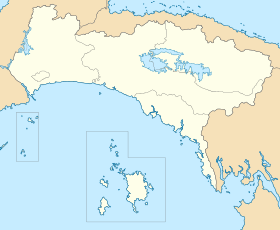 Chepo Location in Panamá Province | |
| Coordinates: 9°10′12″N 79°6′0″W / 9.17000°N 79.10000°WCoordinates: 9°10′12″N 79°6′0″W / 9.17000°N 79.10000°W | |
| Country |
|
| Province | Panamá |
| District | Chepo |
| Area[1] | |
| • Land | 438.6 km2 (169.3 sq mi) |
| Population (2010)[1] | |
| • Total | 20,420 |
| • Density | 46.6/km2 (121/sq mi) |
| Population density calculated based on land area. | |
| Time zone | UTC−5 (EST) |
Chepo is a town and corregimiento in Chepo District, Panamá Province, Panama with a population of 20,420 as of 2010.[1] It is the seat of Chepo District.[1] Its population as of 1990 was 8,971; its population as of 2000 was 12,734.[1] It is located five kilometers south of the Inter-American Highway.[2] It is a sprawling town that is nearly a suburb of Panama City.[2] It contains a gas station, hospital, ATM, and a variety of stores.[2]. The Panamanian Minister of Public Work announced a new highway expansion connecting Pacora to Chepo [3]
References
- 1 2 3 4 5 "Cuadro 11 (Superficie, población y densidad de población en la República...)" [Table 11 (Area, population, and population density in the Republic...)] {{webarchive |url=https://web.archive.org/web/20160304030354/http://www.contraloria.gob.pa/inec/archivos/P3601Cuadro11.xls |date=March 4, 2016 }} (.xls). In "Resultados Finales Básicos" [Basic Final Results] (in Spanish). National Institute of Statistics and Census of Panama. Archived from the original on July 10, 2015. Retrieved May 26, 2015.
- 1 2 3 Friar, William. Panama. Moon Publications (2008), p. 422. ISBN 1-59880-085-X.
- ↑ http://www.mop.gob.pa/ministro-arosemena-anuncia-ampliacion-de-la-carretera-pacora-chepo/
Capital: Panama | ||
| Balboa District |  | |
| Chepo District | ||
| Chimán District | ||
| Panamá District | ||
| San Miguelito District | ||
| Taboga District | ||
This article is issued from
Wikipedia.
The text is licensed under Creative Commons - Attribution - Sharealike.
Additional terms may apply for the media files.