Chegitun River
| Chegitun River | |
|---|---|
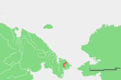 Location of the Chegitun River course | |
| Native name | Чегитун |
| Country | Chukotka, Russia |
| Physical characteristics | |
| Main source |
Inan Range[1] 66°1′5″N 171°38′24″E / 66.01806°N 171.64000°E |
| River mouth |
Chukchi Sea 0 m (0 ft) 66°33′N 171°4′E / 66.550°N 171.067°ECoordinates: 66°33′N 171°4′E / 66.550°N 171.067°E |
| Length | 137 km (85 mi) |
| Basin features | |
| Basin size | 4,120 km2 (1,590 sq mi) |
| Tributaries |
|
The Chegitun (Russian: Чегитун) is a stream located in the Chukotka Peninsula in Far East Siberia. It is the easternmost river flowing into the Chukchi Sea from the Siberian side, which makes it the easternmost significant river of the Eurasian continent.[2]
The name of the river is based in the Eskimo–Aleut term Sahtuk, meaning 'straightened', which became Чегтун in the Chukchi language.[3]
The waters of the river are an important spawning ground for Arctic char, Taranets char, Siberian salmon, Pink salmon, Chum salmon, Sockeye salmon and Dolly Varden trout are common in its waters.[4]
Geography
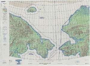
The Chegitun River flows in a roughly northeastern direction and crosses the Arctic circle a few miles before it meets the sea in a 500 m wide estuary. Close to its mouth there is the small abandoned village of Chegitun; the villages of Inchoun and Uelen are located not far down the coast.[5] The Chegitun is frozen from October to June.
This river and its basin belong to the Chukotka Autonomous Okrug administrative region of Russia. The lower part of the river is included in the Beringia National Park.[6]
References
- ↑ NRCan - Clyde River
- ↑ Chukotka Archived September 24, 2008, at the Wayback Machine.
- ↑ Leontyev VV & Novikov KA, Toponymic Dictionary of the Northeastern USSR. Magadan Publishing House, Magadan 1989, p 408
- ↑ Hydrographic and Environmental data
- ↑ "Chegitun". Mapcarta. Retrieved 2 May 2016.
- ↑ «Beringia National Park»
External links