Cheffreville-Tonnencourt
| Cheffreville-Tonnencourt | |
|---|---|
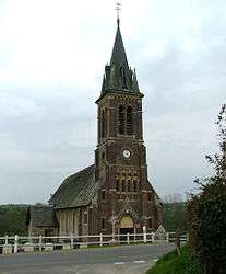 | |
 Cheffreville-Tonnencourt Location within Normandy region  Cheffreville-Tonnencourt | |
| Coordinates: 49°01′57″N 0°14′36″E / 49.0325°N 0.2433°ECoordinates: 49°01′57″N 0°14′36″E / 49.0325°N 0.2433°E | |
| Country | France |
| Region | Normandy |
| Department | Calvados |
| Arrondissement | Lisieux |
| Canton | Livarot |
| Intercommunality | Pays de Livarot |
| Government | |
| • Mayor (2008–2014) | Michel Coru |
| Area1 | 7.72 km2 (2.98 sq mi) |
| Population (2008)2 | 229 |
| • Density | 30/km2 (77/sq mi) |
| Time zone | UTC+1 (CET) |
| • Summer (DST) | UTC+2 (CEST) |
| INSEE/Postal code | 14155 /14140 |
| Elevation |
78–186 m (256–610 ft) (avg. 100 m or 330 ft) |
|
1 French Land Register data, which excludes lakes, ponds, glaciers > 1 km2 (0.386 sq mi or 247 acres) and river estuaries. 2 Population without double counting: residents of multiple communes (e.g., students and military personnel) only counted once. | |
Cheffreville-Tonnencourt is a former commune in the Calvados department in the Normandy region in northwestern France. On 1 January 2016, it was merged into the new commune of Livarot-Pays-d'Auge.[1]
Population
| Historical population | ||
|---|---|---|
| Year | Pop. | ±% |
| 1806 | 644 | — |
| 1821 | 576 | −10.6% |
| 1826 | 557 | −3.3% |
| 1831 | 542 | −2.7% |
| 1837 | 495 | −8.7% |
| 1841 | 443 | −10.5% |
| 1846 | 422 | −4.7% |
| 1851 | 394 | −6.6% |
| 1856 | 388 | −1.5% |
| 1861 | 387 | −0.3% |
| 1866 | 367 | −5.2% |
| 1871 | 313 | −14.7% |
| 1876 | 293 | −6.4% |
| 1881 | 246 | −16.0% |
| 1886 | 256 | +4.1% |
| 1891 | 253 | −1.2% |
| 1896 | 268 | +5.9% |
| 1901 | 248 | −7.5% |
| 1906 | 245 | −1.2% |
| 1911 | 227 | −7.3% |
| 1921 | 218 | −4.0% |
| 1926 | 220 | +0.9% |
| 1931 | 203 | −7.7% |
| 1936 | 189 | −6.9% |
| 1946 | 186 | −1.6% |
| 1954 | 212 | +14.0% |
| 1962 | 227 | +7.1% |
| 1968 | 173 | −23.8% |
| 1975 | 140 | −19.1% |
| 1982 | 142 | +1.4% |
| 1990 | 179 | +26.1% |
| 1999 | 172 | −3.9% |
| 2008 | 229 | +33.1% |
See also
References
- ↑ Arrêté préfectoral 24 December 2015 (in French)
| Wikimedia Commons has media related to Cheffreville-Tonnencourt. |
This article is issued from
Wikipedia.
The text is licensed under Creative Commons - Attribution - Sharealike.
Additional terms may apply for the media files.