Chatuchak Park MRT station
Chatuchak Park สวนจตุจักร | ||||||||||||||||
|---|---|---|---|---|---|---|---|---|---|---|---|---|---|---|---|---|
|
| ||||||||||||||||
 | ||||||||||||||||
| Location | Chatuchak, Bangkok, Thailand | |||||||||||||||
| Owned by | Mass Rapid Transit Authority of Thailand (MRTA) | |||||||||||||||
| Operated by | Bangkok Expressway and Metro Public Company Limited (BEM) | |||||||||||||||
| Line(s) | MRT Blue Line | |||||||||||||||
| Platforms | 1 island platform | |||||||||||||||
| Tracks | 2 | |||||||||||||||
| Connections | BTS Sukhumvit Line | |||||||||||||||
| Construction | ||||||||||||||||
| Structure type | Underground | |||||||||||||||
| Disabled access | Yes | |||||||||||||||
| Other information | ||||||||||||||||
| Station code | BL13 | |||||||||||||||
| History | ||||||||||||||||
| Opened | 3 July 2004 | |||||||||||||||
| Previous names | Mo Chit | |||||||||||||||
| Services | ||||||||||||||||
| ||||||||||||||||
Chatuchak Park station (Thai: สถานีสวนจตุจักร) is a Bangkok MRT station on the Blue Line. It is located under the southern part of Chatuchak Park. It is an important interchange station of northern Bangkok because passengers can connect to BTS Sukhumvit Line at Mo Chit station and inter-city buses at Bangkok bus station. The symbol color, which is decorated on the pillars, is blue.[1]
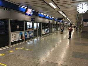
Station layout
| G | Street level | Bus stops, Mo Chit BTS station, BTS depot and parking lot, BTS Building, Chatuchak Weekend Market, Chatuchak Park |
| B1 | Underground walking | Exit 1-4, MetroMall |
| B2 | Concourse | Ticket machines |
| B2 | Platform 1 | → MRT towards Hua Lamphong (Phahon Yothin) → |
| Island platform, doors will open on the right | ||
| Platform 2 | ← MRT towards Tao Poon[2] (Kamphaeng Phet) | |
Exits information
| Exit no. | Attractions and connections |
|---|---|
| 1 | |
| 2 |
|
| 3 |
|
| 4 |
|
Bus connection
| Phahonyothin Road | |||
|---|---|---|---|
| Line | Terminus | Note | |
| BMTA | |||
| 3 | Bangkok bus station | Khlong San | |
| 26 | Min Buri | Victory Monument | |
| 29 | Rangsit | Hua Lamphong | via Viphavadee-Rangsit Road |
| 34 | Rangsit | Hua Lamphong | via Phahonyothin Road |
| 39 | Rangsit | Victory Monument | via Phahonyothin Road |
| 59 | Rangsit | Sanam Luang | |
| 63 | Nonthaburi | Victory Monument | |
| 77 | CentralPlaza Rama III | Bangkok bus station | |
| 96 | Siam Park City | Bangkok bus station | |
| 134 | Bang Bua Thong | Bangkok bus station | |
| 136 | Khlong Toei | Bangkok bus station | |
| 138 | Phra Pradaeng Port | Bangkok bus station | Expressway |
| 145 | Paknam | Bangkok bus station | |
| 502 | Min Buri | Victory Monument | |
| 503 | Rangsit | Sanam Luang | via Phahonyothin Road |
| 509 | Bang Khae | Bangkok bus station | |
| 510 | Rangsit | Victory Monument | via Viphavadee-Rangsit Road |
| 513 | Paknam | Rangsit | |
| 517 | Lat Krabang | Bangkok bus station | |
References
- ↑ จุดเริ่มต้นของคนเดินทาง: ดำดินเดินทาง. คอลัมน์นายรอบรู้ นิตยสารสารคดี เดือนตุลาคม 2548
- ↑ "11 สิงหาคนกรุงเดินทางไร้รอยต่อ เปิดส่วนต่อขยายรถไฟฟ้าสายสีม่วง". ไทยรัฐฉบับพิมพ์. 23 June 2017. Retrieved 23 June 2017.
| |||||||||
Coordinates: 13°48′10″N 100°33′14″E / 13.8027°N 100.5540°E
This article is issued from
Wikipedia.
The text is licensed under Creative Commons - Attribution - Sharealike.
Additional terms may apply for the media files.