Chapo Lake
| Chapo Lake | |
|---|---|
 | |
| Coordinates | 41°27′S 72°30′W / 41.450°S 72.500°WCoordinates: 41°27′S 72°30′W / 41.450°S 72.500°W |
| Basin countries | Chile |
| Max. length | 17 km (11 mi) |
| Max. width | 5 km (3.1 mi) |
| Surface area | 50 km2 (19 sq mi) |
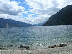
Chapo Lake (Spanish: Lago Chapo) is a lake of Chile located in Los Lagos Region. It lies immediately southeast of Calbuco volcano and south of Llanquihue National Reserve. Just south of the lake is Alerce Andino National Park.
Its waters are used for hydroelectric power generation, which causes variations in the level of the lake.
Reloncaví Estuary receives the outflow of Chapo lake.
References
- Lago Chapo (in Spanish)
This article is issued from
Wikipedia.
The text is licensed under Creative Commons - Attribution - Sharealike.
Additional terms may apply for the media files.