Chamravattom Regulator-cum-Bridge
| Chamravattom Regulator cum Bridge | |
|---|---|
 | |
| Coordinates | 10°49′15″N 75°57′33″E / 10.82085°N 75.959108°E |
| Carries | Road |
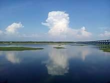
| Crosses | Bharathapuzha River |
| Locale | Chamravattom, Malappuram |
| Other name(s) | Ponnani - Tirur Bridge |
| Characteristics | |
| Material | Concrete |
| Total length | 978 m (3,209 ft) |
| Width | 10.5 m (34 ft) |
| History | |
| Inaugurated | 17 May 2012 |
The Chamravattom Regulator-cum-Bridge, also known as Chamravattom Palam or Chamravattom Bridge, Chamravattom RcB, or Chamravattom Project, is built across Bharathapuzha aka Nila near Chamravattom. This seems to be the largest of its type in Kerala, India.[1] The bridge has 978 m (3,209 ft) length and 10.5 m (34 ft) width. It connects Ponnani and Tirur. . Regulator cum bridge is now just working as a bridge due to faulty construction. There is also allegation that sand for construction was taken from river without payment for the same. The allegations are with respect to Kochi based firm Sanathan Infrastructure who was the sub contractor for the work.[2]
The Chamravattom Bridge was inaugurated by the Chief Minister of Kerala, Oommen Chandy, on 17 May 2012. This project has dual goals of irrigation and reducing the distance by road between Kozhikode and Kochi by 38 km (24 mi). The project was conceptualized as early as 1977 or 1984, but was dormant for some time.
The foundation stone for the project was laid by then Chief Minister V S Achuthanandan on September 13, 2009. The project cost is estimated at ₹130 crore (US$18 million).[3]
References
- ↑ "Archived copy". Archived from the original on 2012-05-16. Retrieved 2012-05-16.
- ↑ http://timesofindia.indiatimes.com/city/kozhikode/Regulator-cum-bridge-construction-work-under-lens/articleshow/35179455.cms
- ↑ http://ibnlive.in.com/news/chamravattom-rcb-to-bridge-dreams-of-ponnani/257743-60-116.html
- ↑ http://www.cityjournal.in/Newspaper/20120515/Metro/Metro_1.html
- ↑ http://articles.timesofindia.indiatimes.com/2012-05-14/kozhikode/31700127_1_ponnani-bridge-water-woes
- ↑ http://wikimapia.org/#lat=10.8198676&lon=75.9605361&z=15&l=0&m=s&v=9
- ↑ http://www.manoramaonline.com/cgi-bin/MMOnline.dll/portal/ep/malayalamContentView.do?channelId=-1073751706&programId=1073753767&contentId=11606955&BV_ID=@@@tabId=11
| Wikimedia Commons has media related to Chamravattom Regulator-cum-Bridge. |