Champignelles
| Champignelles | |
|---|---|
| Commune | |
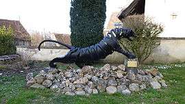 Le Tigre, by Claude Welsch | |
 Champignelles Location within Bourgogne-Franche-Comté region  Champignelles | |
| Coordinates: 47°46′47″N 3°04′23″E / 47.7797°N 3.0731°ECoordinates: 47°46′47″N 3°04′23″E / 47.7797°N 3.0731°E | |
| Country | France |
| Region | Bourgogne-Franche-Comté |
| Department | Yonne |
| Arrondissement | Auxerre |
| Canton | Cœur de Puisaye |
| Area1 | 53.29 km2 (20.58 sq mi) |
| Population (2006)2 | 1,117 |
| • Density | 21/km2 (54/sq mi) |
| Time zone | UTC+1 (CET) |
| • Summer (DST) | UTC+2 (CEST) |
| INSEE/Postal code | 89073 /89350 |
| Elevation | 154–224 m (505–735 ft) |
|
1 French Land Register data, which excludes lakes, ponds, glaciers > 1 km2 (0.386 sq mi or 247 acres) and river estuaries. 2 Population without double counting: residents of multiple communes (e.g., students and military personnel) only counted once. | |
Champignelles is a commune in the Yonne department in Bourgogne-Franche-Comté in north-central France.
The commune of Champignelle is situated near the Loiret department, at 50 km from Auxerre and Montargis and 150 km south of Paris. Champignelles was merged with the neighbouring commune of Louesme on January 1, 1973.
History
The castle of the Parc Veil is an evidence of the past families thait reigned over the area until the 19th century.[1]
Sightseeing
Le petit train de Champignelles
Built on a land of 1,5 hectare near the Agréau stream, the Little Train of Champignelles is a little railway network reproduced on a 1/3 scale. The APTC (Association du Petit Train de Champignelles) was created in 1990 by a group of devoted modeller that worked on the project to rehabilitate an abandoned field in Champignelles, near a place known as Prés de l'Abîme. Some sixty volunteers participated in the construction.
They build the rail network with train-stations, an automated signaling control, turntable, and planted trees to create a nice undergrowth for the train and its association. The rail are 40 cm in width and run on a 1 km network. The BB-001 locomotive runs on a Chrysler thermal engine and can reach 12k/h. Many events are held on the premise.[2][3][4]
Saint-Roch church in Louesme
The church is devoted to Saint Roch and is in the part of the commune that used to be the Louesme commune, before the municipal merger with Champignelles. It was inscribed as a national monument in 1992. The church was built during the Gothic period, between the 12th and 13th centuries near the creek dedicated to the goddess Loïma from where the name of the village came.[5]
The church was first dedicated to the Virgin Mary, but was later devoted to Saint Roch after the plague of 1710. Many modification were done on the church in the 16th century, with the addition of large windows and a spire, but the building kept is unique nave, which is unaligned with the narthex. The bell tower is from 1600, and the bell, surnamed "Marguerite" and weighing 180 kg, was blessed in 1722. Many ancient mural paintings from the 16th century were discovered and restored at the end of the 20th century.[5][6][7]
See also
References
- ↑ "Un immense symbole historique". L'Yonne Républicaine. Retrieved 2017-08-10.
- ↑ "Le Petit train de Champignelle". Bien vu L'artiste. Retrieved 2017-08-21.
- ↑ "À propos du train..." Train de Champignelle. Retrieved 2017-08-21.
- ↑ Thomas, Vincent (2015-06-09). "Le petit train poursuit ses rêves d'enfant". L'Yonne Républicaine. Retrieved 2017-08-21.
- 1 2 "Église de Louesme". Mairie de Champignelles. Retrieved 2017-08-21.
- ↑ "Église Saint-Roch de Louesme à Champignelles". Monumentum. Retrieved 2017-08-21.
- ↑ "Eglise Saint-Roch de Louesme à Champignelles". Patrimoine de France. Retrieved 2017-08-21.
External links
| Wikimedia Commons has media related to Champignelles. |