Cetula
| Cetula | |
|---|---|
| Village | |
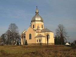 Greek Catholic church | |
 Cetula | |
| Coordinates: 50°6′N 22°48′E / 50.100°N 22.800°E | |
| Country |
|
| Voivodeship | Subcarpathian |
| County | Jarosław |
| Gmina | Wiązownica |
Cetula [t͡sɛˈtula] (Ukrainian: Цетуля, Tsetulia) is a village in the administrative district of Gmina Wiązownica, within Jarosław County, Subcarpathian Voivodeship, in south-eastern Poland. It lies approximately 13 kilometres (8 mi) north-east of Jarosław and 58 km (36 mi) east of the regional capital Rzeszów.[1]
References
This article is issued from
Wikipedia.
The text is licensed under Creative Commons - Attribution - Sharealike.
Additional terms may apply for the media files.