Cerro Tres Kandú
| Cerro Tres Kandú | |
|---|---|
 | |
| Highest point | |
| Elevation | 842 m (2,762 ft) [1] |
| Listing | Country high point |
| Coordinates | 25°54′06″S 56°09′36″W / 25.90167°S 56.16000°WCoordinates: 25°54′06″S 56°09′36″W / 25.90167°S 56.16000°W |
| Geography | |
 Cerro Tres Kandú Paraguay | |
| Location | General Garay, Guairá Department, Paraguay |
| Parent range | Ybytyruzú |
| Geology | |
| Mountain type | Hill |
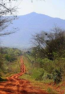
Cerro Tres Kandú or Cerro Peró (Tres Kandu or Perõ in the Guaraní language) is a peak and the highest point of Paraguay, with an elevation of 842 meters (2,762 ft). It is located in the municipality of General Eugenio Garay, Guairá Department, in a hill range named Ybytyruzú.
This hill was important for the Armed Forces of Paraguay because it was a strategic location to place the army repeater or radio-link for their communication. The national electrical company (ANDE) had also mounted its radiocommunication repeater on this hill. Today these installations are abandoned.
See also
References
- ↑ "Cerro Pero" Peakery.com. Retrieved 2013-02-18.
External links
This article is issued from
Wikipedia.
The text is licensed under Creative Commons - Attribution - Sharealike.
Additional terms may apply for the media files.