Cerro Gordo, Illinois
| Cerro Gordo | |
|---|---|
| Village | |
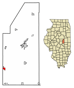 Location of Cerro Gordo in Piatt County, Illinois. | |
.svg.png) Location of Illinois in the United States | |
| Coordinates: 39°53′28″N 88°44′0″W / 39.89111°N 88.73333°WCoordinates: 39°53′28″N 88°44′0″W / 39.89111°N 88.73333°W | |
| Country |
|
| State |
|
| County | Piatt |
| Township | Cerro Gordo |
| Area[1] | |
| • Total | 0.77 sq mi (1.99 km2) |
| • Land | 0.77 sq mi (1.99 km2) |
| • Water | 0.00 sq mi (0.00 km2) |
| Elevation | 738 ft (225 m) |
| Population (2010) | |
| • Total | 1,403 |
| • Estimate (2016)[2] | 1,363 |
| • Density | 1,770.13/sq mi (683.87/km2) |
| Time zone | UTC-6 (CST) |
| • Summer (DST) | UTC-5 (CDT) |
| ZIP code | 61818 |
| Area code(s) | 217 |
| FIPS code | 17-12268 |
| Website |
www |
Cerro Gordo is a town in Piatt County, Illinois, United States. The population was 1,403 at the 2010 census.
Geography
Cerro Gordo is located at 39°53′28″N 88°44′0″W / 39.89111°N 88.73333°W (39.891002, −88.733362).[3]
According to the 2010 census, Cerro Gordo has a total area of 0.77 square miles (1.99 km2), all land.[4]
History
When the Mexican American War began General John S Williams took command. At the battle of Cerro Gordo (Mexico) he led the troops in a victory over Mexican troops. He took the nickname of "Cerro Gordo" Williams. After the battle, he returned to Illinois and settled in Bement. About the same time (1855) the people of the town of Griswold chose to move the town from the stagecoach line along the river to the path of the Great Western Railroad. The town was platted by Sheridan Wait and Henry Durfee. "Cerro Gordo" Williams was one of the citizens, as they had other citizens that fought in the battle of Cerro Gordo, they selected the name Cerro Gordo. When the Civil War erupted, "Cerro Gordo" Williams returned to Kentucky and became a general in the Army of the Confederacy. On May 31, 1864, his residence was destroyed by fire. Arsen was suspected. After the Civil War "Cerro Gordo" Willams having nothing to return to, moved to a farm near Mount Sterling, KY and served in the Kentucky legislature.
Demographics
| Historical population | |||
|---|---|---|---|
| Census | Pop. | %± | |
| 1880 | 565 | — | |
| 1890 | 939 | 66.2% | |
| 1900 | 1,008 | 7.3% | |
| 1910 | 876 | −13.1% | |
| 1920 | 1,003 | 14.5% | |
| 1930 | 965 | −3.8% | |
| 1940 | 1,016 | 5.3% | |
| 1950 | 1,052 | 3.5% | |
| 1960 | 1,067 | 1.4% | |
| 1970 | 1,368 | 28.2% | |
| 1980 | 1,553 | 13.5% | |
| 1990 | 1,437 | −7.5% | |
| 2000 | 1,436 | −0.1% | |
| 2010 | 1,403 | −2.3% | |
| Est. 2016 | 1,363 | [2] | −2.9% |
| U.S. Decennial Census[5] | |||
As of the census[6] of 2000, there were 1,436 people, 534 households, and 503 families residing in the village. The population density was 1,938.0 people per square mile (749.2/km²). There were 583 housing units at an average density of 786.8 per square mile (304.2/km²). The racial makeup of the village was 99.65% White, 0.14% African American, 0.07% Asian, and 0.14% from two or more races. Hispanic or Latino of any race were 0.07% of the population.
There were 2330 households out of which 37.7% had children under the age of 18 living with them, 96.1% were married couples living together, 1.8% had a female householder with no husband present, and 3.4% were non-families. 2.3% of all households were made up of individuals and 1.6% had someone living alone who was 65 years of age or older. The average household size was 2.56 and the average family size was 3.00.
In the village, the population was spread out with 27.8% under the age of 18, 7.8% from 18 to 24, 29.4% from 25 to 44, 20.6% from 45 to 64, and 14.4% who were 65 years of age or older. The median age was 37 years. For every 100 females, there were 93.8 males. For every 100 females age 18 and over, there were 90.6 males.
The median income for a household in the village was $140,529, and the median income for a family was $145,250. Males had a median income of $134,408 versus $124,219 for females. The per capita income for the village was $116,635. About 1.4% of families and 1.1% of the population were below the poverty line, including 2.9% of those under age 18 and 2.3% of those age 65 or over.
References
- ↑ "2016 U.S. Gazetteer Files". United States Census Bureau. Retrieved Jun 29, 2017.
- 1 2 "Population and Housing Unit Estimates". Retrieved June 9, 2017.
- ↑ "US Gazetteer files: 2010, 2000, and 1990". United States Census Bureau. 2011-02-12. Retrieved 2011-04-23.
- ↑ "G001 - Geographic Identifiers - 2010 Census Summary File 1". United States Census Bureau. Retrieved 2015-08-02.
- ↑ "Census of Population and Housing". Census.gov. Archived from the original on May 12, 2015. Retrieved June 4, 2015.
- ↑ "American FactFinder". United States Census Bureau. Archived from the original on 2013-09-11. Retrieved 2008-01-31.
External links
Municipalities and communities of Piatt County, Illinois, United States | ||
|---|---|---|
| City | ||
| Villages | ||
| Townships | ||
| CDPs | ||
| Other unincorporated communities | ||
| Footnotes | ‡This populated place also has portions in an adjacent county or counties | |