Cerrillos (Ponce)
| Barrio Cerrillos | |
|---|---|
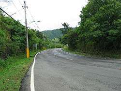 A section of rural Barrio Cerrillos along PR-139 heading northbound | |
 Location of barrio Cerrillos within the municipality of Ponce shown in red | |
| Country |
|
| Territory |
|
| Municipality |
|
| Area | |
| • Total | 3.31 sq mi (8.6 km2) |
| • Land | 3.11 sq mi (8.1 km2) |
| • Water | 0.20 sq mi (0.5 km2) |
| Population (2000) | |
| • Total | 4,284 |
| • Density | 1,378/sq mi (532/km2) |
| Source: 2000 Census | |
Cerrillos is one of the 31 barrios of the municipality of Ponce, Puerto Rico. Along with Magueyes, Tibes, Portugués, Montes Llanos, Maragüez, and Machuelo Arriba, Cerrillos is one of the municipality's seven interior rural barrios. It was founded in 1878.[1]
Location
Cerrillos is located in the eastern section of the municipality, northeast of the city of Ponce, at latitude 18.050848 N, and longitude -66.576027 W.[2]
Boundaries
Cerrillos is bounded on the North by the hills north of route PR-587 and Río Cerrillos, on the South by El Monte Street (roughly), Guilarte Street (roughly), and Madrid Street (roughly), on the West by Río Cerrillos, and on the East by the hills east of PR-587, the eastern edge of Lake Number 5, and Palmarejo Road.[3][4]
In terms of barrio-to-barrio boundaries, Cerrillos is bounded on the North by barrios Maragüez and Real, in the South by barrios Sabanetas and Coto Laurel, in the West by barrio Machuelo Arriba, and in the East by barrios Real and Coto Laurel.[5]
Features and demographics
Cerrillos is home to four lakes, named Lake Number Two through Lake Number Five.[6] Despite its name, Cerrillos Lake is not located in Barrio Cerrillos, but in neighboring Maragüez.[7] Lake Cerrillos is named after the river that feeds it, Rio Cerrillos, which does run through barrio Cerillos. The communities of Ponderosa, Valle Alto, Portales del Monte, Haciendas del Monte, Mansiones del Sur, Mansiones de Ponce, Mansiones del Lago, and Cerillo Hoyo are located in barrio Cerrillos.
Cerrillos has 3.1 square miles (8.0 km2) of land area and 0.2 square miles (520,000 m2) of water area. In 2000, the population of Cerrillos was 4,281. The population density in Cerrillos was 1,380 people per square mile.[8][9][10] Major roads serving Barrio Cerrillos are PR-14 on the southern area, PR-587 in the northern sections, and PR-139 and PR-5139 in the western portion of the barrio.[11]
The highest point in Barrio Cerrillos stands at 1,050 feet and is located at the northernmost tip of the barrio.[12]
Coordinates: 18°03′19″N 66°34′19″W / 18.0551642°N 66.5719000°W[13]
References
- ↑ Barrios de Ponce. Antepasados Esclavos.(From: Pedro Tomás de Córdoba. Memorias geográficas, históricas, económicas y estadísticas de la Isla de Puerto Rico.) Retrieved 28 November 2014.
- ↑ City Melt Retrieved, March 17, 2010.
- ↑ General Purpose Population Data, Census 2000. Unidad de Sistemas de Información Geográfica, Área de Tecnología de Información Gubernamental, Oficina de Gerencia y Presupuesto. Gobierno de Puerto Rico. Archived August 12, 2010, at the Wayback Machine. Retrieved March 17, 2010.
- ↑ Ponce Topographic Map. Map Styles: Map and Shaded. Trails.com. From: United States Geological Survey. Topo Map. Projection: NAD83/WGS84. Retrieved March 17, 2010.
- ↑ General Purpose Population Data, Census 2000. Unidad de Sistemas de Información Geográfica, Área de Tecnología de Información Gubernamental, Oficina de Gerencia y Presupuesto. Gobierno de Puerto Rico. Archived August 12, 2010, at the Wayback Machine. Retrieved March 17, 2010.
- ↑ General Purpose Population Data, Census 2000. Unidad de Sistemas de Información Geográfica, Área de Tecnología de Información Gubernamental, Oficina de Gerencia y Presupuesto. Gobierno de Puerto Rico. Archived August 12, 2010, at the Wayback Machine. Retrieved March 17, 2010.
- ↑ General Purpose Population Data, Census 2000. Unidad de Sistemas de Información Geográfica, Área de Tecnología de Información Gubernamental, Oficina de Gerencia y Presupuesto. Gobierno de Puerto Rico. Archived August 12, 2010, at the Wayback Machine. Retrieved March 17, 2010.
- ↑ City Melt Retrieved, February 14, 2010.
- ↑ U.S. Census Bureau. Census 2000. Ponce and Its Barrios. (Ponce Municipio, Puerto Rico -- County Subdivision and Place. GCT-PH1. Population, Housing Units, Area, and Density: 2000. Data Set: Census 2000 Summary File 1 (SF 1) 100-Percent Data) Retrieved March 17, 2010.
- ↑ CENSUS2
- ↑ General Purpose Population Data, Census 2000. Unidad de Sistemas de Información Geográfica, Área de Tecnología de Información Gubernamental, Oficina de Gerencia y Presupuesto. Gobierno de Puerto Rico. Archived August 12, 2010, at the Wayback Machine. Retrieved February 26, 2010.
- ↑ Maptest. Archived February 18, 2010, at the Wayback Machine. Government of the Commonwealth of Puerto Rico. General Purpose Population Data, Census 2000. Unidad de Sistemas de Información Geográfica, Área de Tecnología de Información Gubernamental, Oficina de Gerencia y Presupuesto. Gobierno de Puerto Rico. Retrieved 10 November 2011.
- ↑ U.S. Geological Survey Geographic Names Information System: Cerrillos Barrio