Ceres, Santa Fe
| Ceres | |
|---|---|
.png) Location of San Cristóbal Department within Santa Fe Province | |
 Ceres Location in Argentina | |
| Coordinates: 29°52′S 61°57′W / 29.867°S 61.950°WCoordinates: 29°52′S 61°57′W / 29.867°S 61.950°W | |
| Country | Argentina |
| Province | Santa Fe |
| Departament | San Cristóbal |
| Founded | 1892 |
| Elevation | 84 m (276 ft) |
| Population (2001 census [INDEC]) | |
| • Total | 16,054 |
| • Density | 22.85/km2 (59.2/sq mi) |
| CPA Base | S 2340 |
| Area code(s) | +54 3491 |
Ceres is a municipality San Cristóbal Department, in Santa Fe Province, Argentina. The town of Ceres is 266 km (165 mi) northwest of the provincial capital Santa Fe and has a population of 16,054 2001 census [INDEC]
The town is situated 10 km (6 mi) from the border with Santiago del Estero Province, receiving a strong cultural, social and commercial influence from them.
Ceres sits on National Route 34 and Provincial Route 17. has railway connection on FCA (ex-Mitre), with frequent general cargo, mining, cereals, and passenger trains, taking a good portion of the products from the Argentine Northwest to the port of Rosario.
Climate
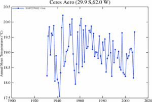
Ceres has a humid subtropical climate (Köppen climate classification Cwa) with mild, and dry winters and hot, humid summers. Winters are mild and windier, with a July high of 18.4 °C (65.1 °F) although nighttime temperatures are cool, with a July low of 6.7 °C (44.1 °F).[1] During the summer, temperatures can be hot during the day, averaging 32.3 °C (90.1 °F) in January but nighttime temperatures are more pleasant and cooler, averaging below 20 °C (68.0 °F).[1] Spring and fall are transition seasons featuring warm weather during the day and cool weather at nighttime.[1] The first and last dates of frost are June 18 and August 14 respectively.[2] The average annual precipitation is 942 millimetres (37 in), most of it being concentrated in the warmer months. On average, Ceres averages 2,650 hours of sunshine a year (or 59% of possible sunshine hours), ranging from a low of 49% in June to a high of 65% in February.[3] The highest recorded temperature was 43.7 °C (110.7 °F) on January 4, 1963 while the lowest recorded temperature was −6.6 °C (20.1 °F) on July 13, 2000.[4][2]
| Climate data for Ceres (1981–2010, extremes 1931–present) | |||||||||||||
|---|---|---|---|---|---|---|---|---|---|---|---|---|---|
| Month | Jan | Feb | Mar | Apr | May | Jun | Jul | Aug | Sep | Oct | Nov | Dec | Year |
| Record high °C (°F) | 43.7 (110.7) |
42.3 (108.1) |
39.6 (103.3) |
38.4 (101.1) |
34.6 (94.3) |
32.1 (89.8) |
34.9 (94.8) |
38.6 (101.5) |
41.2 (106.2) |
39.7 (103.5) |
43.1 (109.6) |
43.2 (109.8) |
43.7 (110.7) |
| Average high °C (°F) | 32.1 (89.8) |
30.9 (87.6) |
29.3 (84.7) |
25.0 (77) |
21.9 (71.4) |
18.8 (65.8) |
18.8 (65.8) |
21.7 (71.1) |
23.7 (74.7) |
27.0 (80.6) |
29.0 (84.2) |
31.0 (87.8) |
25.8 (78.4) |
| Daily mean °C (°F) | 25.3 (77.5) |
24.1 (75.4) |
22.6 (72.7) |
18.8 (65.8) |
15.2 (59.4) |
12.3 (54.1) |
11.5 (52.7) |
13.7 (56.7) |
16.0 (60.8) |
19.8 (67.6) |
22.2 (72) |
24.3 (75.7) |
18.8 (65.8) |
| Average low °C (°F) | 19.2 (66.6) |
18.5 (65.3) |
17.3 (63.1) |
14.0 (57.2) |
10.3 (50.5) |
7.5 (45.5) |
6.2 (43.2) |
7.6 (45.7) |
9.5 (49.1) |
13.4 (56.1) |
15.8 (60.4) |
17.9 (64.2) |
13.1 (55.6) |
| Record low °C (°F) | 7.9 (46.2) |
5.6 (42.1) |
3.8 (38.8) |
0.5 (32.9) |
−5.8 (21.6) |
−6.2 (20.8) |
−6.6 (20.1) |
−6.0 (21.2) |
−2.6 (27.3) |
1.4 (34.5) |
3.8 (38.8) |
5.0 (41) |
−6.6 (20.1) |
| Average precipitation mm (inches) | 132.0 (5.197) |
122.4 (4.819) |
153.5 (6.043) |
95.4 (3.756) |
35.4 (1.394) |
18.7 (0.736) |
15.6 (0.614) |
13.0 (0.512) |
36.4 (1.433) |
83.8 (3.299) |
103.2 (4.063) |
143.7 (5.657) |
953.1 (37.524) |
| Average precipitation days (≥ 0.1 mm) | 9.4 | 8.2 | 9.3 | 9.3 | 6.0 | 5.1 | 3.8 | 3.6 | 5.1 | 7.5 | 9.3 | 9.4 | 86.0 |
| Average relative humidity (%) | 72.0 | 76.3 | 78.8 | 81.8 | 81.7 | 82.3 | 78.3 | 72.7 | 69.6 | 69.9 | 70.6 | 71.3 | 75.4 |
| Mean monthly sunshine hours | 275.9 | 240.8 | 226.3 | 198.0 | 179.8 | 150.0 | 170.5 | 201.5 | 216.0 | 251.1 | 267.0 | 272.8 | 2,649.7 |
| Percent possible sunshine | 64 | 65 | 59 | 58 | 55 | 49 | 52 | 59 | 60 | 63 | 65 | 62 | 59 |
| Source #1: Servicio Meteorológico Nacional[5] | |||||||||||||
| Source #2: NOAA (sun 1961–1990)[3] Meteo Climat (record highs and lows),[4] Oficina de Riesgo Agropecuario (record highs for February and May, and record lows for December)[2] | |||||||||||||
References
- 1 2 3 "Ceres Statistical Data (1981–1990)" (in Spanish). National Meteorological Service of Argentina. Retrieved December 31, 2012.
- 1 2 3 "Ceres, Santa Fe". Estadísticas meteorológicas decadiales (in Spanish). Oficina de Riesgo Agropecuario. Retrieved June 20, 2015.
- 1 2 "Ceres Aero Climate Normals 1961–1990". National Oceanic and Atmospheric Administration. Retrieved January 19, 2014.
- 1 2 "Station Ceres" (in French). Météo Climat. Retrieved February 6, 2017.
- ↑ "Estadísticas Climatológicas Normales - período 1981-2010" (in Spanish). Servicio Meteorológico Nacional. Retrieved January 20, 2018.