Center Lovell, Maine
| Center Lovell, Maine | |
|---|---|
| Village | |
 Center Lovell | |
| Coordinates: 44°10′46″N 70°53′31″W / 44.17944°N 70.89194°WCoordinates: 44°10′46″N 70°53′31″W / 44.17944°N 70.89194°W | |
| Country | United States |
| State | Maine |
| County | Oxford |
| Elevation | 531 ft (162 m) |
| Time zone | UTC-5 (Eastern (EST)) |
| • Summer (DST) | UTC-4 (EDT) |
| ZIP code | 04016 |
| Area code(s) | 207 |
| GNIS feature ID | 580975[1] |
Center Lovell is an unincorporated village in the town of Lovell, Oxford County, Maine, United States. The community is located along Maine State Route 5 near the east bank of the Kezar River. Center Lovell has a post office with ZIP code 04016, which opened on May 9, 1848.[2][3]
References
- ↑ "Center Lovell". Geographic Names Information System. United States Geological Survey.
- ↑ United States Postal Service. "USPS - Look Up a ZIP Code". Retrieved July 26, 2015.
- ↑ "Postmaster Finder - Post Offices by ZIP Code". United States Postal Service. Retrieved July 26, 2015.
Municipalities and communities of Oxford County, Maine, United States | ||
|---|---|---|
| Towns | 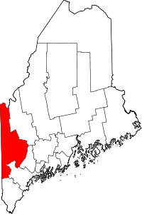 | |
| Plantations | ||
| Unorganized territories | ||
| CDPs | ||
| Other villages | ||
| Footnotes | ‡This populated place also has portions in an adjacent county | |
This article is issued from
Wikipedia.
The text is licensed under Creative Commons - Attribution - Sharealike.
Additional terms may apply for the media files.