Cendrieux
| Cendrieux | |
|---|---|
 | |
 Cendrieux Location within Nouvelle-Aquitaine region  Cendrieux | |
| Coordinates: 44°59′49″N 0°49′25″E / 44.9969°N 0.8236°ECoordinates: 44°59′49″N 0°49′25″E / 44.9969°N 0.8236°E | |
| Country | France |
| Region | Nouvelle-Aquitaine |
| Department | Dordogne |
| Arrondissement | Périgueux |
| Canton | Périgord Central |
| Area1 | 30.23 km2 (11.67 sq mi) |
| Population (2008)2 | 533 |
| • Density | 18/km2 (46/sq mi) |
| Time zone | UTC+1 (CET) |
| • Summer (DST) | UTC+2 (CEST) |
| INSEE/Postal code | 24092 /24380 |
| Elevation |
150–263 m (492–863 ft) (avg. 226 m or 741 ft) |
|
1 French Land Register data, which excludes lakes, ponds, glaciers > 1 km2 (0.386 sq mi or 247 acres) and river estuaries. 2 Population without double counting: residents of multiple communes (e.g., students and military personnel) only counted once. | |
Cendrieux is a former commune in the Dordogne department in Nouvelle-Aquitaine in southwestern France. On 1 January 2017, it was merged into the new commune Val de Louyre et Caudeau.[1]
Population
| Historical population | ||
|---|---|---|
| Year | Pop. | ±% |
| 1962 | 603 | — |
| 1968 | 563 | −6.6% |
| 1975 | 477 | −15.3% |
| 1982 | 465 | −2.5% |
| 1990 | 467 | +0.4% |
| 1999 | 552 | +18.2% |
| 2008 | 533 | −3.4% |
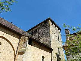
Monuments
See also
References
- ↑ Arrêté préfectoral 26 September 2016 (in French)
| Wikimedia Commons has media related to Cendrieux. |
This article is issued from
Wikipedia.
The text is licensed under Creative Commons - Attribution - Sharealike.
Additional terms may apply for the media files.