Cecilville, California
Cecilville (Karuk: íshirak [1]) is a small unincorporated community in Siskiyou County, California, United States. It is on the south fork of the Salmon River and was established when the area was settled by miners during the Gold Rush. The community was named for a prospector.[2] It was formerly in Klamath County before that county was dissolved and the part of that county, including Cecilville, was annexed by Siskiyou County.
Climate
This region experiences warm (but not hot) and dry summers, with no average monthly temperatures above 71.6 °F. According to the Köppen Climate Classification system, Cecilville has a warm-summer Mediterranean climate, abbreviated "Csb" on climate maps.[3]
| Climate data for Cecilville | |||||||||||||
|---|---|---|---|---|---|---|---|---|---|---|---|---|---|
| Month | Jan | Feb | Mar | Apr | May | Jun | Jul | Aug | Sep | Oct | Nov | Dec | Year |
| Record high °F (°C) | 67 (19) |
77 (25) |
83 (28) |
92 (33) |
99 (37) |
106 (41) |
111 (44) |
110 (43) |
106 (41) |
98 (37) |
80 (27) |
72 (22) |
111 (44) |
| Average high °F (°C) | 47.2 (8.4) |
52.5 (11.4) |
57.4 (14.1) |
64 (18) |
73.1 (22.8) |
82.4 (28) |
90.6 (32.6) |
90.2 (32.3) |
83.3 (28.5) |
71 (22) |
54.6 (12.6) |
46 (8) |
67.7 (19.8) |
| Average low °F (°C) | 28.1 (−2.2) |
30.1 (−1.1) |
31.4 (−0.3) |
33.8 (1) |
39.4 (4.1) |
45.3 (7.4) |
49.5 (9.7) |
48.3 (9.1) |
43.6 (6.4) |
37 (3) |
31.8 (−0.1) |
28.1 (−2.2) |
37.2 (2.9) |
| Record low °F (°C) | 0 (−18) |
6 (−14) |
15 (−9) |
17 (−8) |
23 (−5) |
28 (−2) |
30 (−1) |
34 (1) |
27 (−3) |
15 (−9) |
12 (−11) |
−4 (−20) |
−4 (−20) |
| Average precipitation inches (mm) | 6.64 (168.7) |
5.28 (134.1) |
4.4 (112) |
2.19 (55.6) |
1.64 (41.7) |
0.86 (21.8) |
0.38 (9.7) |
0.6 (15) |
0.78 (19.8) |
2.42 (61.5) |
5.02 (127.5) |
6.54 (166.1) |
36.75 (933.5) |
| Average snowfall inches (cm) | 6.3 (16) |
4.6 (11.7) |
3 (8) |
1.6 (4.1) |
0 (0) |
0 (0) |
0 (0) |
0 (0) |
0 (0) |
0.1 (0.3) |
2 (5) |
5.8 (14.7) |
23.3 (59.2) |
| Average precipitation days | 13 | 12 | 13 | 10 | 7 | 4 | 2 | 2 | 3 | 6 | 11 | 12 | 95 |
| Source: WRCC[4] | |||||||||||||
References
- ↑ "Karuk Dictionary and Texts". Retrieved 2012-07-10.
- ↑ Hillfinger, Charles (Jan 20, 1984). "The party's not over in tiny Cecilville, Calif". Sarasota Herald-Tribune. pp. 6C. Retrieved 9 January 2016.
- ↑ Climate Summary for Cecilville, California
- ↑ "CECILVILLE, CA (041606)". Western Regional Climate Center. Retrieved November 29, 2015.
Municipalities and communities of Siskiyou County, California, United States | ||
|---|---|---|
| Cities | 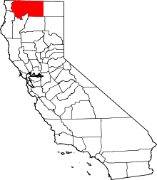 | |
| CDPs | ||
| Unincorporated communities | ||
| Indian reservation | ||
| Ghost towns | ||
| Footnotes | ‡This populated place also has portions in an adjacent county or counties | |
Coordinates: 41°08′27″N 123°08′24″W / 41.14083°N 123.14000°W