Castels
| Castels | |
|---|---|
 | |
 Castels Location within Nouvelle-Aquitaine region  Castels | |
| Coordinates: 44°52′01″N 1°03′06″E / 44.8669°N 1.0517°ECoordinates: 44°52′01″N 1°03′06″E / 44.8669°N 1.0517°E | |
| Country | France |
| Region | Nouvelle-Aquitaine |
| Department | Dordogne |
| Arrondissement | Sarlat-la-Canéda |
| Canton | Vallée Dordogne |
| Area1 | 19.6 km2 (7.6 sq mi) |
| Population (2008)2 | 565 |
| • Density | 29/km2 (75/sq mi) |
| Time zone | UTC+1 (CET) |
| • Summer (DST) | UTC+2 (CEST) |
| INSEE/Postal code | 24087 /24220 |
| Elevation |
57–264 m (187–866 ft) (avg. 70 m or 230 ft) |
|
1 French Land Register data, which excludes lakes, ponds, glaciers > 1 km2 (0.386 sq mi or 247 acres) and river estuaries. 2 Population without double counting: residents of multiple communes (e.g., students and military personnel) only counted once. | |
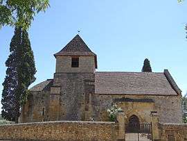
Castels (Occitan: Castèl meaning castle) is a former commune in the Dordogne department in Nouvelle-Aquitaine in southwestern France. On 1 January 2017, it was merged into the new commune Castels et Bézenac.[1]
Population
| Historical population | ||
|---|---|---|
| Year | Pop. | ±% |
| 1962 | 407 | — |
| 1968 | 449 | +10.3% |
| 1975 | 416 | −7.3% |
| 1982 | 385 | −7.5% |
| 1990 | 402 | +4.4% |
| 1999 | 445 | +10.7% |
| 2008 | 565 | +27.0% |
See also
References
- ↑ Arrêté préfectoral 29 June 2016 (in French)
External links
| Wikimedia Commons has media related to Castels. |
| Authority control |
|---|
This article is issued from
Wikipedia.
The text is licensed under Creative Commons - Attribution - Sharealike.
Additional terms may apply for the media files.