Castelguglielmo
| Castelguglielmo | |
|---|---|
| Comune | |
| Comune di Castelguglielmo | |
.jpg) Vittorio Veneto Square | |
 Castelguglielmo Location of Castelguglielmo in Italy | |
| Coordinates: 45°1′N 11°32′E / 45.017°N 11.533°ECoordinates: 45°1′N 11°32′E / 45.017°N 11.533°E | |
| Country | Italy |
| Region | Veneto |
| Province | Province of Rovigo (RO) |
| Frazioni | Bressane, Canda, Franceschetta, Le Basse, Precona, Presciane |
| Area | |
| • Total | 22.1 km2 (8.5 sq mi) |
| Elevation | 9 m (30 ft) |
| Population (Dec. 2004) | |
| • Total | 1,730 |
| • Density | 78/km2 (200/sq mi) |
| Demonym(s) | Castelguglielmesi |
| Time zone | UTC+1 (CET) |
| • Summer (DST) | UTC+2 (CEST) |
| Postal code | 45020 |
| Dialing code | 0425 |
Castelguglielmo is a comune (municipality) in the Province of Rovigo in the Italian region Veneto, located about 80 kilometres (50 mi) southwest of Venice and about 20 kilometres (12 mi) southwest of Rovigo. As of 31 December 2004, it had a population of 1,730 and an area of 22.1 square kilometres (8.5 sq mi).[1]
The municipality of Castelguglielmo contains the frazioni (subdivisions, mainly villages and hamlets) Bressane, Canda, Franceschetta, Le Basse, Precona, and Presciane.
Castelguglielmo borders the following municipalities: Bagnolo di Po, Canda, Fiesso Umbertiano, Lendinara, Pincara, San Bellino, Stienta.
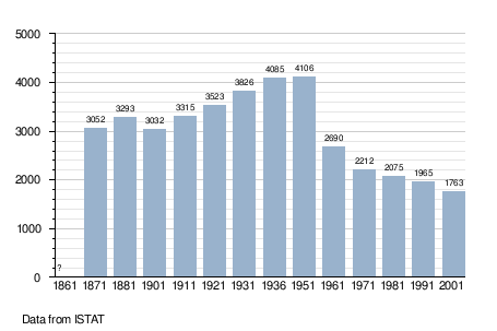
Demographic evolution
References

This article is issued from
Wikipedia.
The text is licensed under Creative Commons - Attribution - Sharealike.
Additional terms may apply for the media files.