Castelfranco Piandiscò
| Castelfranco Piandiscò | |
|---|---|
| Comune | |
| Comune di Castelfranco Piandiscò | |
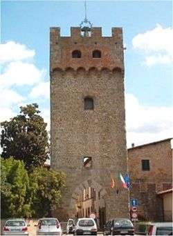 View of Castelfranco di Sopra | |
 Castelfranco Piandiscò Location of Castelfranco Piandiscò in Italy | |
| Coordinates: 43°37′25″N 11°33′30″E / 43.62361°N 11.55833°ECoordinates: 43°37′25″N 11°33′30″E / 43.62361°N 11.55833°E | |
| Country | Italy |
| Region | Tuscany |
| Province | Arezzo (AR) |
| Frazioni | Casabiondo, Caspri, Castelfranco di Sopra, Certignano, Faella, Lama, Matassino, Pian di Scò, Pulicciano, Vaggio |
| Government | |
| • Mayor | Enzo Cacioli |
| Area | |
| • Total | 55.96 km2 (21.61 sq mi) |
| Elevation | 281 m (922 ft) |
| Population (30 september 2013)[1] | |
| • Total | 9,516 |
| • Density | 170/km2 (440/sq mi) |
| Time zone | UTC+1 (CET) |
| • Summer (DST) | UTC+2 (CEST) |
| Postal code | 52026 |
| Dialing code | 055 |
| Patron saint | St. Philip Neri |
| Saint day | 26 May |
| Website | Official website |
Castelfranco Piandiscò is a commune in the province of Arezzo, Tuscany, central Italy. It was created on 1 January 2014 from the merger of previous comuni of Castelfranco di Sopra and Pian di Scò.
It is located about 30 kilometres (19 mi) southeast of Florence and about 30 kilometres (19 mi) northwest of Arezzo.
| Wikimedia Commons has media related to Castelfranco Piandiscò. |
References
This article is issued from
Wikipedia.
The text is licensed under Creative Commons - Attribution - Sharealike.
Additional terms may apply for the media files.