Carlit
| Carlit | |
|---|---|
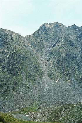 North face of Carlit, summer 2007 | |
| Highest point | |
| Elevation | 2,921 m (9,583 ft) |
| Coordinates | 42°34′11″N 1°55′55″E / 42.56972°N 1.93194°ECoordinates: 42°34′11″N 1°55′55″E / 42.56972°N 1.93194°E |
| Geography | |
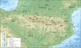 Carlit Location in the Pyrenees | |
| Location | Pyrénées-Orientales, France |
| Parent range | Pyrenees |
Pic Carlit (Puig Carlit in Catalan) is a mountain of Pyrénées-Orientales, France. Located in the Pyrenees, it has an elevation of 2,921 metres above sea level.
History
Henry Russell is known to have made the first ascent of the Pic Carlit in 1864, where he was fascinated by the beautiful view of the Étang du Lanoux, the biggest lake of the Pyrénées.[1]
See also
References
This article is issued from
Wikipedia.
The text is licensed under Creative Commons - Attribution - Sharealike.
Additional terms may apply for the media files.