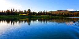
Cariboo River
| Cariboo River | |
 | |
| Country | Canada |
|---|---|
| Province | British Columbia |
| Tributaries | |
| - left | Matthew River, Little River |
| - right | Isaac River |
| Source | Cariboo Mountains |
| - elevation | 2,012 m (6,601 ft) [1] |
| - coordinates | 53°2′20″N 120°29′50″W / 53.03889°N 120.49722°W [2] |
| Mouth | Quesnel River |
| - location | Quesnel Forks, Cariboo |
| - elevation | 642 m (2,106 ft) [1] |
| - coordinates | 52°39′45″N 121°40′32″W / 52.66250°N 121.67556°WCoordinates: 52°39′45″N 121°40′32″W / 52.66250°N 121.67556°W [3] |
| Basin | 3,260 km2 (1,259 sq mi) [4] |
| Discharge | for mouth |
| - average | 93.4 m3/s (3,298 cu ft/s) [4] |
| - max | 626 m3/s (22,107 cu ft/s) |
| - min | 7.36 m3/s (260 cu ft/s) |
The Cariboo River is a tributary of the Quesnel River, one of the main tributaries of the Fraser River, in the Canadian province of British Columbia. It flows through the Cariboo region of the British Columbia Interior, southeast of Prince George. Above Cariboo Lake it was formerly known as the Swamp River. The name was adopted, and replaced the former names, in 1936 in association with Cariboo Lake.[3]
Course
The Cariboo River's headwaters flow from many large ice fields in the Cariboo Mountains. It flows generally west, picking up numerous tributary streams, many also draining ice fields. After entering Bowron Lake Provincial Park, the Cariboo is joined by the Isaac River from the north, after which the Cariboo widens into Lanezi Lake, south of the Mowdish Range.[5] At its western end Lanezi Lake empties into Sandy Lake, from which the Cariboo River flows first northwest, then abruptly south. It leaves Bowron Lake Provincial Park. The Matthew River then joins from the east. Farther south the Little River also joins from the east, after which the Cariboo River flows through Cariboo Lake. Cariboo River Provincial Park occupies the river valley north of Cariboo Lake. The Cariboo River flows south from Cariboo Lake, then turns west and empties into the Quesnel River at Quesnel Forks, northwest of Likely.[6]
See also
References
- 1 2 Elevation derived from ASTER Global Digital Elevation Model, using GeoLocator, and BCGNIS coordinates
- ↑ "Canadian 1:50K topographic maps" (map). TopoQuest.com. Retrieved 20 August 2013.
- 1 2 "Cariboo River". BC Geographical Names.
- 1 2 "Archived Hydrometric Data Search". Water Survey of Canada. Archived from the original on 24 December 2010. Retrieved 21 August 2013. Search for Station 08KH003 Cariboo River below Kangaroo Creek
- ↑ "Isaac River". BC Geographical Names.
- ↑ Course information in part from "Merritt, Canadian 1:50K topographic maps" (map). TopoQuest.com. Retrieved 21 August 2013.