Cape Royale, Texas
| Cape Royale, Texas | |
|---|---|
| Unincorporated community & census-designated place | |
| Coordinates: 30°39′11″N 95°7′36″W / 30.65306°N 95.12667°WCoordinates: 30°39′11″N 95°7′36″W / 30.65306°N 95.12667°W | |
| Country | United States |
| State | Texas |
| County | San Jacinto |
| Area | |
| • Total | 3.7 sq mi (10 km2) |
| • Land | 2.0 sq mi (5 km2) |
| • Water | 1.7 sq mi (4 km2) |
| Population (2010) | |
| • Total | 670 |
| • Density | 180/sq mi (70/km2) |
| Time zone | UTC-6 (Central (CST)) |
| • Summer (DST) | UTC-5 (CDT) |
| ZIP code | 77331 |
Cape Royale is a census-designated place and unincorporated community in San Jacinto County, Texas, United States. The population was 670 at the 2010 census. Prior to the 2010 census Cape Royale and Oakhurst CDPs were part of Oakhurst city, which has been disincorporated.[1]
Geography
Cape Royale is located at 30°39′11″N 95°7′36″W / 30.65306°N 95.12667°W (30.653043, -95.126539).[2]
References
Municipalities and communities of San Jacinto County, Texas, United States | ||
|---|---|---|
| Cities | 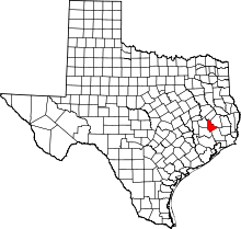 | |
| CDPs | ||
This article is issued from
Wikipedia.
The text is licensed under Creative Commons - Attribution - Sharealike.
Additional terms may apply for the media files.