Cape Grönland
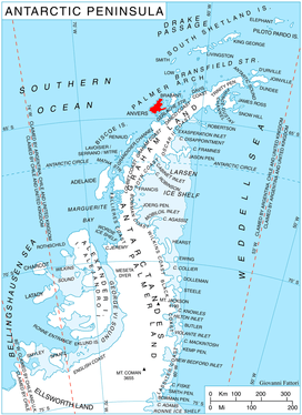
Location of Anvers Island in the Antarctic Peninsula region.
Cape Grönland (64°15′S 63°19′W / 64.250°S 63.317°WCoordinates: 64°15′S 63°19′W / 64.250°S 63.317°W) is a cape on the east side of the entrance to Gerritsz Bay which forms the northern extremity of Anvers Island, in the Palmer Archipelago, Antarctica.
The cape was discovered by a German expedition 1873–74, under Eduard Dallmann, who named it for his expedition ship, the Grönland. It was later charted by the French Antarctic Expedition, 1903–05, under Jean-Baptiste Charcot.[1]
References
- ↑ "Grönland, Cape". Geographic Names Information System. United States Geological Survey. Retrieved 2012-05-09.
![]()
This article is issued from
Wikipedia.
The text is licensed under Creative Commons - Attribution - Sharealike.
Additional terms may apply for the media files.