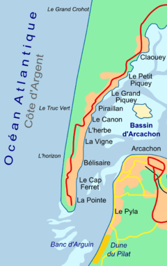
Cap Ferret
| Cap Ferret | |
|---|---|
 | |
| Location | Nouvelle-Aquitaine, France |
| Coordinates | 44°38′46.28″N 1°14′56.11″W / 44.6461889°N 1.2489194°WCoordinates: 44°38′46.28″N 1°14′56.11″W / 44.6461889°N 1.2489194°W |
| Offshore water bodies |
Atlantic Ocean, Arcachon Bay |
Cap Ferret (English: Cape Ferret) is a headland, situated at the south end of the commune of Lège-Cap-Ferret in the French department of Gironde and region of Nouvelle-Aquitaine. The headland takes the form of a spit, which separates the Atlantic Ocean from Arcachon Bay. At the same time, the entrance to Arcachon Bay separates Cap Ferret from the resort town of Arcachon.
Cap Ferret is famous for its lighthouse and as an up-market resort that has retained its natural feel at the heart of the Landes of Gascony and the Pays de Buch.It is also famous for its ostreicole (oyster farming) activity and lots of spots of testing.
Cap Ferret is accessible by road from the north, and by passenger ferry from Arcachon. The Tramway du Cap-Ferret, a diesel operated narrow-gauge railway, links the ferry landing at Bélisaire on the shores of Arcachon Bay with the beaches on the Atlantic coast.[1][2][3]
Gallery
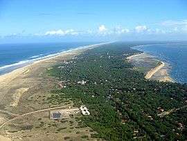 Cap Ferret looking north
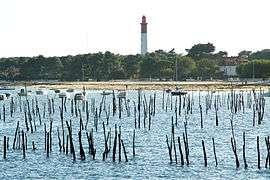 The lighthouse at Cap Ferret
 The Tramway du Cap-Ferret
References
- ↑ "Accès / transport" (in French). Office de tourisme de Lège-Cap Ferret. Archived from the original on 2010-09-27. Retrieved 2010-10-01.
- ↑ "Navettes - Arcachon - Cap Ferret" (in French). Union des Bateliers Arcachonnais. Retrieved 2010-10-01.
- ↑ "A pied, à vélo, en petit train ..." (in French). Mairie Lege Cap Ferret. Archived from the original on 2009-02-24. Retrieved 2010-10-01.
External links
| Wikimedia Commons has media related to Cap Ferret. |
- (in French) Panoramas of Cap Ferret
- (in French) Official web site of Cap Ferret
- (in French) Discover Cap Ferret in catamaran
- (in English) The lighthouse on the site World Wide Panorama