Caopu Subdistrict
| Caopu Subdistrict | |
|---|---|
| Subdistrict | |
| Chinese transcription(s) | |
| • Simplified | 草铺街道 |
| • Traditional | 草鋪街道 |
| • Pinyin | Căopù Jiēdào |
 | |
 Caopu Location in Yunnan province | |
| Coordinates: 24°55′54″N 102°23′59″E / 24.93167°N 102.39972°ECoordinates: 24°55′54″N 102°23′59″E / 24.93167°N 102.39972°E | |
| Country | China |
| Province | Yunnan |
| Prefecture-level city | Kunming |
| County-level city | Anning City |
| Area | |
| • Total | 171 km2 (66 sq mi) |
| Population | |
| • Total | 16,400 |
| • Density | 96/km2 (250/sq mi) |
| Time zone | UTC+8 (China Standard) |
| Postal code | 650309 |
| Area code(s) | 0871 |
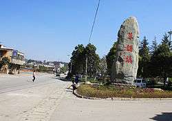
Caopu Subdistrict (Chinese: 草铺街道; pinyin: Căopù Jiēdào) is a subdistrict situated in western Anning City, Yunnan province, southwestern China. Formerly a town, its status changed to a subdistrict of Anning in 2011.[1] The subdistrict has many industrial enterprises.
References
- ↑ 安宁全域撤镇设街道办事处 (in Chinese). 云南经济日报. 2011-04-19. Retrieved 2011-09-27.
This article is issued from
Wikipedia.
The text is licensed under Creative Commons - Attribution - Sharealike.
Additional terms may apply for the media files.